littlek
 
Reply Sun 11 Feb, 2007 09:15 am
I started a thread about Cape Cod (Massachusetts) a long time ago. I wanted a place from which I could share info, stories and photos of one of my favorite places on earth. The thread took a wonderful turn into a many-paged thread for folks reminiscing about their camp experience on Cape Cod from the 1960-70s. I want to leave that thread alone, for them (and me, it's fun to read along sometimes).
  • Topic Stats
  • Top Replies
  • Link to this Topic
Type: Discussion • Score: 5 • Views: 16,961 • Replies: 40
No top replies

 
jespah
 
  1  
Reply Sun 11 Feb, 2007 09:19 am
We're going to Dennisport in May. My way of bookmarking. http://www.cyberrentals.com/vd2/propmaps/WVR/EN/mass_detail_capecod07-05-6_336887.png

Can't wait.
0 Replies
 
littlek
 
  1  
Reply Sun 11 Feb, 2007 09:53 am
AAAAAAAAAAAAAAAAAAAAAAAAAAAAAAAGH! I had just typed out one of my longest posts, complete with pictures and diagrams - kitty sat in the wrong place and it is gone. Sigh.
0 Replies
 
Slappy Doo Hoo
 
  1  
Reply Sun 11 Feb, 2007 09:55 am
Dammit, now we'll never know the answers to how stonehenge was built.

I almost never go to the cape. Rt 3 sucks.
0 Replies
 
edgarblythe
 
  1  
Reply Sun 11 Feb, 2007 09:59 am
In the 70s, I lived in Providence. Drove out on the Cape just once, to have a look. It's a wonderful place, but, even then, the traffic required more patience than I cared to muster.
0 Replies
 
littlek
 
  2  
Reply Sun 11 Feb, 2007 10:07 am
I'll do it in smaller chunks........

The towns and regions of Cape Cod (CC)

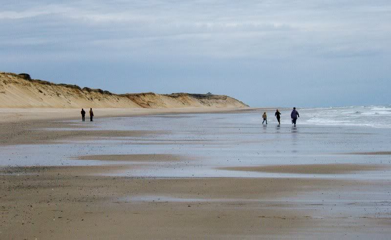
Cape Cod is a sandy spit left behind when the glaciers retreated around 18,000 years ago. As the glacier left, it gouged up bits of sand and left some of it's ice behind to fill those holes with icy water. Today, we call them kettle ponds. I wonder about how much of the actual glacier water is still in those ponds. And, what would one find if one core sampled the silt below the water. You can see by looking at the photo below and Jespah's above, why people refer to the cape as if it were an arm, bent at the elbow. My parents live just North of the elbow. At the finger tips is Provincetown (P-town) and in the arm pit is Woods Hole.

http://photojournal.jpl.nasa.gov/jpegMod/PIA02633_modest.jpg

Sand, in the face of ocean waves, sea winds and NorEasters, doesn't hold up. CC is eroding at several feet each year. Lighthouses have been moved inland. Roads (see photo below) and houses have fallen off the sea cliffs. Man made structures have been laid down to stop erosion and this has disrupted the natural flow of sand - see, the sand redeposits elsewhere along the CC seashore. In one spot, a barrier beach called North Beach, has been breached and remade over and over again over the last several hundred years. It protects a little baylette called Pleasant Bay in Chatham (photo below). The bay is difficult to navigate because the sand shifts all the time.

http://groups.msn.com/_Secure/0UgCMGOkZjVfXfFI2OojzG8UovbHkArRuuom4hgZDScLQRyCLzGgBttaRVT5i0Q0IQEoMqafmZrNANNJN4yitjU5Uw1LNTq!NajmA3UiSLCmdyMO73toQyG5dTvklDcUE/BeachRoadEndCoastGaurd.jpg

http://www.chathambookstore.com/books/images/breakthrough_lg.jpg
0 Replies
 
littlek
 
  1  
Reply Sun 11 Feb, 2007 10:13 am
If you go at the right times, it's not bad. Leave late, go in spring time or autumn........ I only go to the beach on the off season.
0 Replies
 
littlek
 
  2  
Reply Sun 11 Feb, 2007 10:27 am
Nation Seashore

http://www.new-england-vacations-guide.com/images/caco_map_area.jpg

As you can see, the National Seashore is huge! It covers over 43,000 acres, is 40 miles long. It is comprised of upland scrub, kettle ponds, marshes, bogs and shoreline one both the ocean and bayside of CC.

There are 11 hiking trails of various lengths and difficulties. My favorites are the White Cedar Swamp Trail (easy), the Fort Hill Trail (easy-medium) Beach Forest Trail (medium - bring birdfeed and feed the birds!) and the Great Island Trail (difficult). Along these trails the hiker has magnificent views of landscapes and wildlife.

Beach Forest
http://groups.msn.com/_Secure/0VQC7Dy4bccm8B6GKjvKImjiyI3N2VrqoPmlQQyMESn2Q76eAgSWa28xzcF9F8GT6gDpHNNA*7h!BHeTCp2zjDlnSiq9HBcxMpvGnq*M!WxA!mMOeUymfkJLzWYHw4wSi/beachforestchickadeekris2.JPG

Great Island
http://groups.msn.com/_Secure/0VwCDD!0bXwO98EaHIonJg6n91UHI!tFlYEG5Q5dF*LO0ZquGTeEWGQCBncuygyFDtXCheD4*cyJQC1GJtLmbwdR7hjHg*osG9flkOesCx!TpBPCHQn4B0x7uSgh2yDk2/dec05greatilshikemarshsmall.JPG

Fort Hill
http://i72.photobucket.com/albums/i175/Gigipix/2006_08_Gartersnakesunning_mapleswa.jpg
http://i72.photobucket.com/albums/i175/Gigipix/th_DSCF2935.jpg

White Cedar Swamp
http://i72.photobucket.com/albums/i175/Gigipix/Cape%20Cod/2006decembercedarswamptrail3.jpg
0 Replies
 
littlek
 
  2  
Reply Sun 11 Feb, 2007 10:52 am
Edit (Moderator): Image converted to URL due to browser malware warnings.

http://www.capecodchamber.org/images/CapeCodRegionsMap.gif


Cape Cod is divvied up into 4 regions. The Upper Cape is the chunk nearest the mainland, along the canal. Here is a power station and an army base as well as the Woods Hole Oceanographic Institute. The character is sort of 1950s amusement parkish. Not the most aesthetically pleasing spot. Next section is called Mid Cape. This is the most urban, I'd say, part of the cape. Hyannis is here as are strip malls and mcdonalds. The lower Cape is further East - to the elbow of the cape. Orleans is here, another city, though of a more moderate size than Hyannis. Beyond the elbow is the Outer Cape. It includes the artist colony town of Wellfleet and Provincetown which is a traditional fishing village, an elite beach home community and a gay pride mecca all in one.

Provincetown

http://i72.photobucket.com/albums/i175/Gigipix/ptownfromthewater2.jpg

http://i72.photobucket.com/albums/i175/Gigipix/Cape%20Cod/ptownvecchiaportrait2small.jpg

I did not take this one, but I love it! (also p-town)
http://graphics.boston.com/bonzai-fba/Globe_Photo/2006/06/22/1151000759_2802.jpg

Wellfleet (appropriately a painting!)

http://www.fosteringarts.org/003-08_Wellfleet_Bay.jpg
0 Replies
 
littlek
 
  1  
Reply Sun 11 Feb, 2007 11:13 am
National Seashore, Part II - I forgot the beaches! I guess that's telling.

Some beaches (off-season of course). Starting in Orleans.

Nauset Beach. This is a 10 mile stretch from Orleans to Chatham - part of this shoreline is the piece in Chatham which was cut across by a winter storm a few years back. I dunno much about this beach. I think it's the one where you can float on your back and ride the current around the bend of the beach. (photo below is not one of mine)
http://www.okonfamily.com/dennis/albums/misc/images/photos/2005/04/10/PICT0001.JPG

Coast Guard beach is named after the Coast Guard Station there. This is one of my favorite patches, maybe because it's also the closest to my parents' house. The seacliffs are tall, you can look at the strata within them, freshly exposed after storms and high winds. Chunks of clay, small rocks of all types can be found among the sand. The sea grass helps to hold the sand in place.

http://i72.photobucket.com/albums/i175/Gigipix/Cape%20Cod/2006_12_pepismomatmarconi3.jpg

clay
http://i72.photobucket.com/albums/i175/Gigipix/Cape%20Cod/2006decembersandsculpturesatmarconi.jpg
0 Replies
 
dyslexia
 
  1  
Reply Sun 11 Feb, 2007 11:35 am
"(Cape Cod is)... a vast morgue, where famished dogs may range in packs - the most uninviting landscape on earth."
Henry David Thoreau
0 Replies
 
plainoldme
 
  1  
Reply Sun 11 Feb, 2007 02:33 pm
I would love to spend some time on the Cape. My former husband's best friend's family had a house there and he spent much of his college and young adult vacation time there. The parents were divorced around the time we met and the house was sold. My ex spent several years complaining about the Cape until he again knew someone who lived there and could visit without paying for lodging. So, I'd love to go there and get to know the place on my own without those memories.
0 Replies
 
littlek
 
  1  
Reply Sun 11 Feb, 2007 02:50 pm
Yes, and thoreau liked it.

POM, it's hard to get to know on a limited budget unless you know someone there. One could always camp.

A2K gummed up as I was posting. More beaches to come (I am supposed to be writing lesson plans, can you tell?)
0 Replies
 
littlek
 
  1  
Reply Sun 11 Feb, 2007 03:05 pm
North of Coast Guard we come to Fort Hill and Salt Pond. Neither are beaches, really, but they are part of the park system. Salt Pond is where the visitor Center is. Both spots have marshlands between the main land and the sea and they are very close together. Foot paths tunnel in the scrubby oak and pitch pine forests that grow on the sea cliffs. Fort Hill is not a paved pathway, most of Salt Pond is paved with bike trails to boot.

View from the top of Fort Hill
http://i72.photobucket.com/albums/i175/Gigipix/Cape%20Cod/2006_08_forthillmarsh1.jpg

Salt Pond
http://i72.photobucket.com/albums/i175/Gigipix/Cape%20Cod/SaltPond.jpg
0 Replies
 
littlek
 
  1  
Reply Sun 11 Feb, 2007 03:18 pm
Nauset Light Beach is similar to Nauset Beach and Coast Guard. I'll skip photos of it. On to Marconi Beach. This is where the White Cedar Swamp Trail is, where the Marconi telegraph station museum is (or it's most current incarnation). There's a look out deck from which you can see both the Atlantic and the CC Bay. I stood there on New Year's Eve 1999 and shot some amazing sunset pictures. Further North are the dunes of Provincetown and Race Point. Race Point has an old Lifesaving Station museum. The museum is paltry, but kind of neat. What's super cool is that they do a re-enactment of lifesaving techniques from the start of the 1900s.

A link to the Lifesaving Station information: STATIONS+
0 Replies
 
littlek
 
  1  
Reply Sun 11 Feb, 2007 03:38 pm
Then there's the Bay side. Here there are smaller waves and when the tide goes out, you can sometimes walk for miles out into the tidal flats. Wellfleet juts into the bay and has a lot of shoreline within it (this is where the Great Island Hike is). I am most familiar with the Eastham bay side. Every road heading West seems to dead end on a beach or close to one. First Encounter Beach is where Pilgrims first met the Natives of this area. They'd stopped closer to p-town and stolen the Wampanoag's seed corn as well as other things. Some Wampanoag had seen this and went to get some others. They followed the boat from shore and met them when they landed at First Encounter. I imagine there was some explaining to do. The beach is a stretch of sand with bay waters on one side and marshland on the other. Another neat spot is Rock Harbor. A dredged shipway allows local fishing boats to come and go on the high tide. Dead trees sunk into the tidal flats line one side of the safe waters.

A cool image of 1st Encounter. The marsh had been harvested for salt hay, the canals never went away. The marsh is home to coyotes and osprey as well as the more common owls, hawks, foxes, bob whites, bunnies, etc.
http://www.skypic.com/ma/18-9757.jpg

Funny little Rock Harbor - you can just make out the trees beyond the rocks
http://www.capecod-orleans.com/Tour/images/rockharbor.jpg
0 Replies
 
jespah
 
  1  
Reply Sun 11 Feb, 2007 05:06 pm
Cape Code lighthouse at Truro http://www.asergeev.com/pictures/archives/compress/2004/383/jpeg/18.jpg
0 Replies
 
plainoldme
 
  1  
Reply Tue 13 Feb, 2007 03:27 pm
Beautiful pictures, guys!

When my 27 y/o son was 16, he went to the summer camp called Science at Sea which is based on the Cape. I drove him there and picked him up. He talked all the way home. The camp is expensive (his father paid) but wonderful. The kids learn marine bio and navigation.
0 Replies
 
Dipthong
 
  1  
Reply Sun 25 Feb, 2007 04:25 pm
I spent the most fantastic holiday of my life in Boston and NY last September, missed the leaves, global warming......Took the bus out to Hyannis from Boston. Sorry we didn't get more time to investigate. Hoping to come back soon!

*Lives in Wales, UK*

Could post some pics of the town....Hyannis that is.
0 Replies
 
littlek
 
  1  
Reply Sun 25 Feb, 2007 06:20 pm
Sure, go ahead Dipthong! Though, to cape codders, that town is their city.
0 Replies


Related Topics

My kind of town, Chicago is... - Discussion by JPB
Cape Cod - Discussion by littlek
Transportation options -- New Jersey to NYC - Discussion by joefromchicago
Why Illinois Sucks - Discussion by cjhsa
La Guardia or Newark? - Discussion by dagmaraka
Went to Denver, Christmas Week - Discussion by edgarblythe
Iselin, New Jersey - Discussion by Thomas
Question on Niagara Falls - Discussion by Slappy Doo Hoo
 
  1. Forums
  2. » Why I love Cape Cod
Copyright © 2024 MadLab, LLC :: Terms of Service :: Privacy Policy :: Page generated in 0.04 seconds on 04/27/2024 at 07:04:50