1
   

EARTH+MOON+SUN-What are there Rotational+Orbital Velocities?


HofT
 
  1  
Reply Sun 16 Jan, 2005 12:14 pm
The India plate is moving north - definite on that part.

I don't know which way the Burma plate moves, but there's no reason to assume that it matters in this case - no matter its direction the overlap is bound to cause earthquakes.
0 Replies
 
Bibliophile the BibleGuru
 
  1  
Reply Mon 17 Jan, 2005 09:47 am
What does it matter which direction the plates are moving? Is the resultant tsunami still not going to cause the Earth's day to be changed?
0 Replies
 
HofT
 
  1  
Reply Tue 18 Jan, 2005 11:46 am
I don't see whether temporary oceanic motions like tsunamis or tidal waves can have any effect on rotation period of planets - only a permanent rearrangement of the mass would.
0 Replies
 
HofT
 
  1  
Reply Tue 18 Jan, 2005 11:47 am
In the case of the Indian plate direction of motion does matter, since it pushes the Himalayas higher as it moves northwards.
0 Replies
 
georgeob1
 
  1  
Reply Tue 18 Jan, 2005 01:17 pm
yes but the motion of the plate itself to higher latitudes has the (very slight) effect of decreasing the rotational inertia - balancing the effect of raising mountains. Both effects are far too small to be detected in any observations we can make.
0 Replies
 
Bibliophile the BibleGuru
 
  1  
Reply Wed 19 Jan, 2005 06:28 am
HofT wrote:
I don't see whether temporary oceanic motions like tsunamis or tidal waves can have any effect on rotation period of planets - only a permanent rearrangement of the mass would.


I agree. I'm still not visualising the technical explanations behind this.
0 Replies
 
rosborne979
 
  1  
Reply Wed 19 Jan, 2005 08:06 am
Bibliophile the BibleGuru wrote:
HofT wrote:
I don't see whether temporary oceanic motions like tsunamis or tidal waves can have any effect on rotation period of planets - only a permanent rearrangement of the mass would.


I agree. I'm still not visualising the technical explanations behind this.


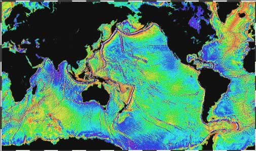
I don't think the argument behind the spin rate of the planet has anything to do with the tidal waves themselves, but with the density and distrubution of the Earth's crust in relation to the distance from the center or rotation.

See below:

http://antwrp.gsfc.nasa.gov/apod/image/0307/gravityearth2_grace.gif

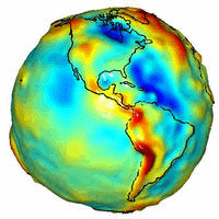
If any of those red areas were to sink closer to the core and displace a blue area upward, then the spin rate should increase.
0 Replies
 
HofT
 
  1  
Reply Thu 20 Jan, 2005 06:56 am
Same map as posted by Rosborne in equatorial projection:

http://topex.ucsd.edu/WWW_images/mar_grav/global_grav.jpg
http://topex.ucsd.edu/marine_grav/mar_grav.html

The Indian and Burma plates meet in the north-south undersea ridge almost 1,000 miles long between the 2 regions.
0 Replies
 
HofT
 
  1  
Reply Thu 20 Jan, 2005 07:30 am
It's a complex model:

http://sealevel.jpl.nasa.gov/newsroom/features/images/main-feature-tsunami.jpg
http://sealevel.jpl.nasa.gov/

G OB: there are in fact instruments to measure those changes by satellite-to-satellite microwave measurements. Which reminds me - it's incredible that maps of undersea mountains freely available on the internet weren't provided to the submarine which ran into such a mountain in the Pacific.
0 Replies
 
georgeob1
 
  1  
Reply Thu 20 Jan, 2005 08:21 am
I had to go through Navy Nucear power training at a fairly late stage of my career. While the encounters with Rickover were interesting enough, the experience left me with mixed feelings about submariners - very proficient, but they inhabit a very elliptical, bounded world. Aviators were more parabolic and ... cool.

There have been several submarine encouners with seamounts. Most usually only involve denting the relatively fragile bow sonar structure. I'm sure they all had the charts. Knowing where you are within hundreds of meters while submerged is easy: knowing within meters is much harder (no GPS down there). Most people don't realize how closely these things are routinely done.

I used to find the undersea charts fascinating. There are Everests unseen under the Pacific.
0 Replies
 
HofT
 
  1  
Reply Fri 21 Jan, 2005 05:56 am
Back to Bibliophile's original Q for a second, these people have some of the best simulation programs on the net, including underwater topography as estimated by satellite - click on topo map and update:
http://www.fourmilab.ch/cgi-bin/uncgi/Earth/action?opt=-s

See you all in February sometime - and thanks again to G OB.
0 Replies
 
Bibliophile the BibleGuru
 
  1  
Reply Fri 21 Jan, 2005 07:02 am
Ros and Hoft: thanks for the graphics - they're very interesting.
0 Replies


Related Topics

Evolution 101 - Discussion by gungasnake
Typing Equations on a PC - Discussion by Brandon9000
The Future of Artificial Intelligence - Discussion by Brandon9000
The well known Mind vs Brain. - Discussion by crayon851
Scientists Offer Proof of 'Dark Matter' - Discussion by oralloy
Blue Saturn - Discussion by oralloy
Bald Eagle-DDT Myth Still Flying High - Discussion by gungasnake
DDT: A Weapon of Mass Survival - Discussion by gungasnake
 
Copyright © 2024 MadLab, LLC :: Terms of Service :: Privacy Policy :: Page generated in 0.04 seconds on 04/23/2024 at 04:35:09