Foofie
 
  -1  
Reply Thu 12 Dec, 2013 10:42 am
@Lordyaswas,
Lordyaswas wrote:

Foofie wrote:

izzythepush wrote:

Still just a passing fad.


You have though taught me what so many Irish-Americans have realized much longer than many other ethnic Americans - the Brits tend to be assholes.


And we all know that Irish-Americans are the fount of all knowledge! Very Happy

However, I tend to agree with you, Miller, apart from one small aspect.

You included the English.


Many Americans consider all English to be Brits, and all Brits to be English. Only the Scots might be thought to be something else; possibly Celts that wound up Presbyterian?
izzythepush
 
  1  
Reply Thu 12 Dec, 2013 11:16 am
@Foofie,
http://2.bp.blogspot.com/_2QJSeWQoKyA/TOEuHmAUu_I/AAAAAAAAIvw/vB_y99UYQF4/s400/james_blunt400x300.jpg
saab
 
  1  
Reply Thu 12 Dec, 2013 12:17 pm
@Lordyaswas,

English as a Scandinavian language
linguistics professors Jan Terje Faarlund (Oslo) and Joseph Emonds (Palacky) claims it is. According to them, Middle English represents too much of a break with Old English for a direct relationship to be plausible. Also, the similarities with Scandinavian languages are found where things normally don't change - in the most commonly used words and syntax.

Some commonly used words that seem to derive from Scandinavian languages:
Anger, awe, bag, band, big, birth, both, bull, cake, call, cast, cosy, cross, die, dirt, dream, egg, fellow, flat, gain, get, gift, give, guess, guest, hug, husband, ill, kid, law, leg, lift, likely, link, loan, loose, low, mistake, odd, race, raise, root, rotten, same, seat, seem, sister, skill, skin, skirt, sky, steak, though, thrive, Thursday (and the rest), tight, till, trust, ugly, want, weak, window, wing, wrong
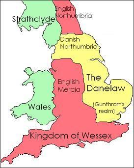
Places which end with -by certainly are Scandinavian. Grimsby, Hemsby
neologist
 
  1  
Reply Thu 12 Dec, 2013 12:45 pm
@izzythepush,
Your avatar is nothing like you.
timur
 
  1  
Reply Thu 12 Dec, 2013 12:48 pm
@neologist,
He bluntly says..
0 Replies
 
Setanta
 
  1  
Reply Thu 12 Dec, 2013 12:49 pm
@saab,
From the late ninth century to the beginning of the eleventh century, much of England had been overrun by Danes, who were often accompanied by the Norse. Your list of common nouns is deceptive because English derives from several old Germanic languages, including the languages of the Frisians, the Saxons, the Anglen, the Jutes and the Danes. There should be no surprise about that. Cnut the Great of Denmark was the king of England (along with Denmark, Norway and parts of what are now Sweden) at the end of the tenth century. Cnut's sons attempted to succeed him in this northern empire, but without success. From 866, Danes ruled most of northern England, and slowly attempted to conquer the rest of the country. They overran East Anglia, and the northern portion of Mercia (the midlands). For the next 12 years, they attempted, but repeatedly failed to overrun Wessex (basically, England south of the river Thames). In 884, Guthrum the Unlucky again attempted to conquer Wessex and southern Mercia, failed, and concluded a treaty with Alfred of Wessex which established the Danelaw--that portion of the island which would be under Danish rule.

It's not as though what you have to say will be news to anyone familiar with the history of England.
Lordyaswas
 
  1  
Reply Thu 12 Dec, 2013 04:42 pm
@Foofie,
...."Many Americans consider all English to be Brits, and all Brits to be English. Only the Scots might be thought to be something else; possibly Celts that wound up Presbyterian?".......

Well, your collective ignorance is duplicated across the pond, as we all consider you Yanks, but I now know from experience that quite a few from the US take exception to that.

Just goes fo show that we're all ignorant sometimes.
0 Replies
 
Lordyaswas
 
  1  
Reply Thu 12 Dec, 2013 04:47 pm
@Setanta,
Danelaw map.


http://i3.photobucket.com/albums/y60/Cecasander/1066/Danelawkingdoms.jpg
Setanta
 
  1  
Reply Thu 12 Dec, 2013 05:04 pm
@Lordyaswas,
I think that map inaccurately portrays the portions of Mercia which were effectively under Danish control. After the Danes under Guthrum were defeated at Exeter, he moved them to Gloucester. It was from there that he launched his sudden twelfth-night attack on Cirencester. Mercia may have been notionally free, but it was effectively under the control of the Danes.
Lordyaswas
 
  1  
Reply Thu 12 Dec, 2013 05:06 pm
Here's a very good nutshell style history.......

http://www.worldfamilies.net/surnames/britton/mtdna


Snippets.....(don't show this first snippet to Olly for gawd's sake....as it looks like Brittany is indeed as English as it is French!

"During the fifth century AD Angles, Saxons, and Jutes began to invade Britain in increasing numbers, causing some Britons to flee the country and settle along the western coast of France in what later became known as Brittany. "


Re. 1066....
"This last Germanic invasion, therefore, was also the smallest, although its lasting effect on the language and culture as well as the political, social, and economic structure of Britain would be hard to overestimate. In a word, everything in England changed after 1066, and one of the most potent legacies of the Conquest for genealogists is that it erased much of the history of Anglo-Saxon England. Only a handful of leading families--Berkeley, Arden, and one or two others--can be traced before 1066. The Old English aristocracy was systematically disenfranchised and replaced by William's Norman, Breton, and Flemish followers, the evidence for which was duly recorded in Domesday twenty years later."

Just as a matter of interest, William Shakespeare's Mother had the maiden name of Arden
Lordyaswas
 
  1  
Reply Thu 12 Dec, 2013 05:16 pm
@Setanta,
That's probably the case, Set, as I had a double take at the map as well.
My old history teacher used to tell us that the Danelaw boundary ran all the way up the old Roman road called Watling Street (A5). Anything to the northern side of Watling was Danelaw, and South of that road was not.

If you take a straight line from the bottom left corner of the yellow on that map, and go straight for the top "pigs ear" (Anglesey) of Wales...that's pretty much how Watling Street runs, give or take a few miles.

I've lived in three different properties on Watling Street, and bloody noisy they all were too. It starts at Marble Arch in London and goes in pretty much a straight line all the way to Anglesey. Good engineers, those Romans.
Smileyrius
 
  1  
Reply Thu 12 Dec, 2013 05:17 pm
I have to say, the side track in this thread makes thrilling reading, who knew! I feel like Im actually learning something!
Lordyaswas
 
  1  
Reply Thu 12 Dec, 2013 05:18 pm
@Smileyrius,
We aim to please, but expect a 20% tip at the end. Very Happy
0 Replies
 
Setanta
 
  1  
Reply Thu 12 Dec, 2013 05:22 pm
@Lordyaswas,
Yes, the Romans never let minor things like swamps, elevations, mountains, rivers, etc., to stand in the way of road building. What's even more amazing is how the vestiges of the roads are still visible, running as straight as a rule, two thousand years later.
Lordyaswas
 
  1  
Reply Thu 12 Dec, 2013 05:33 pm
@Setanta,
We've been watching archaeologists working away on an old drover's lane near us, and often chat to them as we walk the dogs.
They've now dated the ancient hedgrow through which we chat, to over a thousand years old.
The road part is now tarmac and enough for single line traffic, and one of the history guys there showed us how they could tell it was a drover's route.
If you stand in the road and stretch one arm out to the side so it touches the hedge, then you should precisely touch the hedge on the other side if you hold out a drover's crook (shepherd's crook, much the same thing)
It was to stop the cows from escaping back past the cowman.

Apparently there are thousands of these drovers routes up and down the country, all the same width, and some dating way back into the dark ages.
Most of them are now tarmaced country lanes that cars tootle along without even thinking about the history they're passing through.
Lordyaswas
 
  1  
Reply Thu 12 Dec, 2013 05:35 pm
@Lordyaswas,
Off to bed now, as I've gone boss eyed and am yawning like buggery.

G'night one and all.
0 Replies
 
izzythepush
 
  1  
Reply Fri 13 Dec, 2013 01:55 am
@Lordyaswas,
The Fosse way, though officially a B road is still very much in use. I used it to take my parents from Bristol to E. Yorkshire, it's still the most direct route and a lot nicer than a motorway.
Lordyaswas
 
  1  
Reply Fri 13 Dec, 2013 02:58 am
@izzythepush,
There is also Peddars Way, from near Thetford, it runs a dead straight line right up to the Wash.
Most, if not all of it is pedestrian only, and is great for walking holidays as it's not only level, but right away from modern civilisation most of the way.
The last time I walked it, I had a labrador cross who was expert at rousing pheasant. He would either smell them from a great distance, or was telepathic in some way, but he would "put up" at least one or two every hundred yards or so.
If I remember correctly, the Peddars Way has an area of small puddles along its route, called pingoes (it was over twenty years ago, but I'm sure of pingo) which a local told me was a Roman word (I was probably spun a yarn).
He also said the road pre-dated the Romans, and all they did was to improve the walking surface and place mile distance markers. Mile of course, comes from mille signalling a thousand times a soldiers right foot lands...ie two thousand actual strides, which works out at approx 1760 yards even today, so it shows our legs haven't grown or shrunk much.

Peddars Way.....
http://www.contours.co.uk/walking-holidays/maps/peddars-way-norfolk-coast-map.gif
0 Replies
 
Lordyaswas
 
  1  
Reply Fri 13 Dec, 2013 03:08 am
Pingos.....

http://www.norfolkwildlifetrust.org.uk/Wildlife-in-Norfolk/Habitat-explorer/Pingos.aspx
0 Replies
 
Setanta
 
  1  
Reply Fri 13 Dec, 2013 04:15 am
The word pingo is also (coincidentally) used to describe a mound which forms when sodden land freezes and rises . . .

Quote:
A pingo, also called a hydrolaccolith, is a mound of earth-covered ice found in the Arctic and subarctic that can reach up to 70 metres (230 ft) in height and up to 600 m (2,000 ft) in diameter. The term originated as the Inuvialuktun word for a small hill. A pingo is a periglacial landform, which is defined as a nonglacial landform or process linked to colder climates.
Periglacial suggests an environment located on the margin of past glaciers. However, freeze and thaw cycles influence landscapes outside areas of past glaciation. Therefore, periglacial environments are anywhere freezing and thawing modify the landscape in a significant manner. They are essentially formed by ground ice which develops during the winter months as temperatures fall. The plural form is "pingos".


(From the Wikipedia entry on pingo.)

http://upload.wikimedia.org/wikipedia/commons/8/85/Pingos_near_Tuk.jpg
 

Related Topics

 
Copyright © 2024 MadLab, LLC :: Terms of Service :: Privacy Policy :: Page generated in 0.03 seconds on 05/04/2024 at 08:19:40