fbaezer
 
  1  
Reply Tue 5 Feb, 2013 06:49 pm
Between traditional Cuajimalpa and the newer zones, we find a couple of colonias. Navidad (lower-middle class) and San José de los Cedros (working class):

http://imganuncios.mitula.net/5978_rur_casa_en_cond_en_rta_san_jose_de_los_cedros_tabiquera_96862840232320235.jpg

http://imganuncios.mitula.net/5868_rar_depto_en_rta_san_jose_de_los_cedros_prol_ocote_96862839965097662.jpg
0 Replies
 
fbaezer
 
  2  
Reply Tue 5 Feb, 2013 06:55 pm
Then, nearing the center of the city, come colonias for the upper-middle and the rich. Lomas de Bezares, Vista Hermosa and Bosques de las Lomas:

http://safe-img02.olx.com.mx/ui/9/76/47/f_333756947-3265730280.jpeg

http://www.atrium.com.mx/images/listing_photos/2325_bezares.jpg

http://safe-img02.olx.com.mx/ui/5/61/17/1273948595_93475417_2-Fotos-de--VENTA-CASA-LOMAS-DE-BEZARES-CERCA-DE-SANTA-FE-POLANCO-BOSQUES-DE-LAS-LOMAS-INTERLOMAS-1273948595.jpg

http://4.bp.blogspot.com/_0J6wiDolkRE/TIFawdKGR8I/AAAAAAAAALU/sBy8VLNCanQ/s640/ClubdeTiro2.jpg
0 Replies
 
fbaezer
 
  2  
Reply Tue 5 Feb, 2013 07:03 pm
...And relatively near these posh neighborhoods, stands Santa Fe, where big corporations have their offices.

https://encrypted-tbn1.gstatic.com/images?q=tbn:ANd9GcTQRiJGPSoHl_SgVXV-F5hZo7kP6rGanRKxkpz3jmv5sGk5xT8u

https://encrypted-tbn2.gstatic.com/images?q=tbn:ANd9GcS2pxW9XAKsn3SBKZ6QmxD0yqnF7Waxku4LDRDUFphADvMMxBO1Nw

http://upload.wikimedia.org/wikipedia/commons/thumb/9/98/Mexico_Dic_06_209.jpg/280px-Mexico_Dic_06_209.jpg

https://encrypted-tbn2.gstatic.com/images?q=tbn:ANd9GcTSHVe2vcz1hiLbpC85Nx_1awjBSFKfeIMJaJ09C_JuE93xTEt3xQ
0 Replies
 
fbaezer
 
  2  
Reply Tue 5 Feb, 2013 07:07 pm
This building is called by the people "Los Pantalones" (The Pants).

http://mediac1.viva-images.com/vivastreet_mx/classified/1f/0/31748016/large/2.jpg?dt=07d341bf370ecfce0b30ae8626be2b2f

And this one is "El Servilletero" (The Napkin Holder):

http://www.ciudadmexico.com.mx/images/zones/santafe/calakmul.jpg
0 Replies
 
fbaezer
 
  2  
Reply Tue 5 Feb, 2013 07:23 pm
Two important private universities have a campus at Santa Fe.

Universidad Iberoamericana (Jesuits) has its main campus:

https://encrypted-tbn0.gstatic.com/images?q=tbn:ANd9GcQOnQCFFkFjeO7Vda_ecl5yHFRHBgz6MLnMEF9ouOIS55JZVbkV

http://turespacio.com/wp-content/uploads/2012/10/Universidad-Iberoamericana.jpg

And ITESM (popularly known as "Tec de Monterrey") has one of its three city campuses at Santa Fe:

https://encrypted-tbn2.gstatic.com/images?q=tbn:ANd9GcQ1eSbRqbDzcPGDyo1v7WRBs39kqChV9QacpvdXC-3m1yvWr5g6

http://www.cnnexpansion.com/media/2010/10/06/edificio-para-la-biblioteca-y-escuela-de-graduados-en-administracion-y-direccion-de-empresas-egade-del-instituto-tecnologico-y-de-estudios-superiores-de-monterrey-campus-santa-fe.jpg
0 Replies
 
Ceili
 
  3  
Reply Tue 5 Feb, 2013 08:49 pm
https://pbs.twimg.com/media/BBZL8AiCYAA9m9k.jpg:large
https://twitter.com/Cmdr_Hadfield
A picture of Mexico city from space.
fbaezer
 
  3  
Reply Tue 5 Feb, 2013 09:03 pm
@Ceili,
http://tenoch.scimexico.com/wp-content/uploads/2007/11/aereanocturna.jpg
0 Replies
 
fbaezer
 
  2  
Reply Thu 7 Feb, 2013 05:49 pm
We move from the extreme west of the city to the extreme east, Delegación Tláhuac.

http://upload.wikimedia.org/wikipedia/commons/thumb/c/c2/Tl%C3%A1huac_locator_map.svg/250px-Tl%C3%A1huac_locator_map.svg.png

Since there are no subway stations in Cuajimalpa, we go by car. We manage to do it outside rush hour. We drive for two hours.
0 Replies
 
fbaezer
 
  2  
Reply Thu 7 Feb, 2013 05:50 pm
Here, an aerial picture of Tláhuac, dominated by the extinct Xico volcano:

http://tenoch.scimexico.com/wp-content/uploads/2007/11/crater_xico_tlahuac.jpg
fbaezer
 
  2  
Reply Thu 7 Feb, 2013 05:54 pm
Tláhuac was a rural place when I was a child. It grew from the 70s to the 90s until a prohibition for new -and farther away- housing developments stood.

This is the parish at the town of Tláhuac:

http://upload.wikimedia.org/wikipedia/commons/thumb/9/9e/ParishSanPedroTlahuac_03.JPG/800px-ParishSanPedroTlahuac_03.JPG

And this is the old municipal building:

http://upload.wikimedia.org/wikipedia/commons/thumb/6/64/Tl%C3%A1huac-Antiguo_ayuntamiento.JPG/800px-Tl%C3%A1huac-Antiguo_ayuntamiento.JPG

Lake Reyes, next to the town of Tláhuac:

http://upload.wikimedia.org/wikipedia/commons/thumb/7/7f/LagoReyesTlahuac.JPG/800px-LagoReyesTlahuac.JPG
0 Replies
 
fbaezer
 
  2  
Reply Thu 7 Feb, 2013 05:58 pm
An image of San Juan Ixtayopan (Tláhuac):

http://upload.wikimedia.org/wikipedia/commons/thumb/e/e3/Ixtayopan-Carreta_de_mulitas.JPG/800px-Ixtayopan-Carreta_de_mulitas.JPG

The town of Santa Catarina Yecahuizótl (Tláhuac)

http://upload.wikimedia.org/wikipedia/commons/thumb/c/c8/Yecahu%C3%ADzotl-Plaza_del_pueblo.JPG/800px-Yecahu%C3%ADzotl-Plaza_del_pueblo.JPG

Tláhuac Avenue, at Colonia Selene:

http://upload.wikimedia.org/wikipedia/commons/thumb/5/51/Tlaltenco-Vista_de_la_avenida_Tl%C3%A1huac_hacia_el_sur.jpg/800px-Tlaltenco-Vista_de_la_avenida_Tl%C3%A1huac_hacia_el_sur.jpg

Tláhuac is full of working class and poor neighborhoods such as this one.
0 Replies
 
fbaezer
 
  2  
Reply Thu 7 Feb, 2013 06:00 pm
Another Tláhuac scene:

http://upload.wikimedia.org/wikipedia/commons/thumb/d/d4/Tl%C3%A1huac-Bicitaxistas.JPG/800px-Tl%C3%A1huac-Bicitaxistas.JPG
0 Replies
 
fbaezer
 
  2  
Reply Thu 7 Feb, 2013 06:19 pm
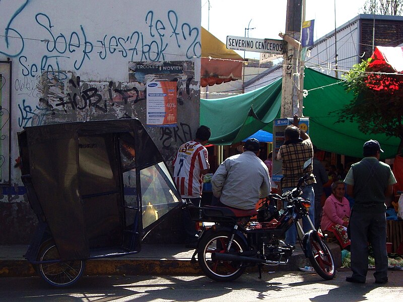
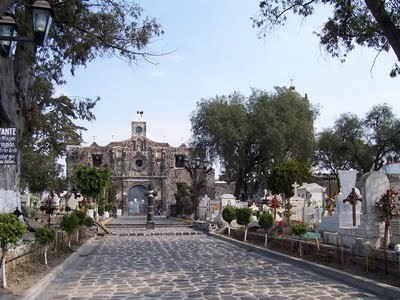
The most interesting place in Tláhuac is a town named Mixquic, where ancient indian traditions persist.

Mixquic is famous for its Day of the Death ceremonies.

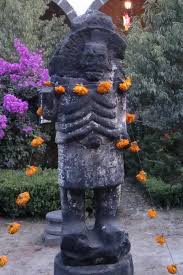
This image is from last year:

http://1.bp.blogspot.com/-bnmlqNlU0UA/UI9oAjEUkKI/AAAAAAAABxM/MBFZRoaiavk/s1600/Alumbrada+2+de+noviembre+Mixquic.JPG

http://www.record.com.mx/sites/default/files/pictures/03/11/2011/rf021111reportaje_mixquic_06.jpg

http://www.eluniversaldf.mx/fotos/mixquic.jpg

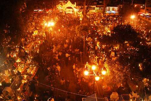
Mictlantecuhtli, Aztec god of the afterlife, also presides the rites. He's properly adorned with Cempazúchitl flowers (Flower of the Dead).

https://encrypted-tbn3.gstatic.com/images?q=tbn:ANd9GcSBiV41cMOgaXRfTy02qqUBwDi4O1zUfLCqOchQaYMZfYyM25HSkQ

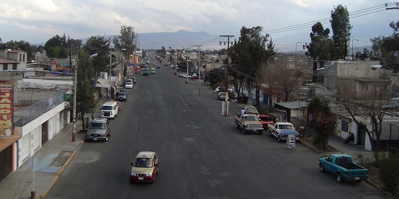
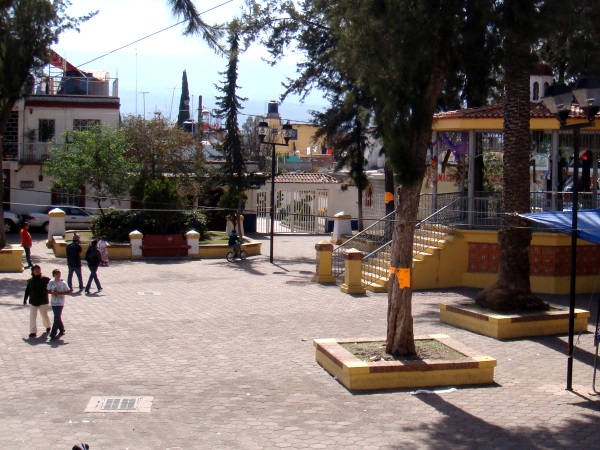
The town of Mixquic:
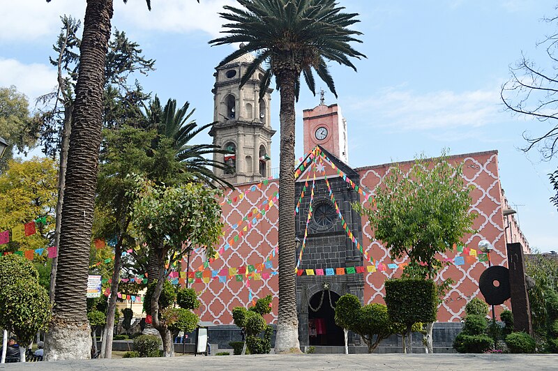
http://media.tumblr.com/tumblr_mcqpu4t4bD1rpmjza.jpg

Inside the church:

http://img.terra.com.mx/galeria_de_fotos/images/433/864397.jpg

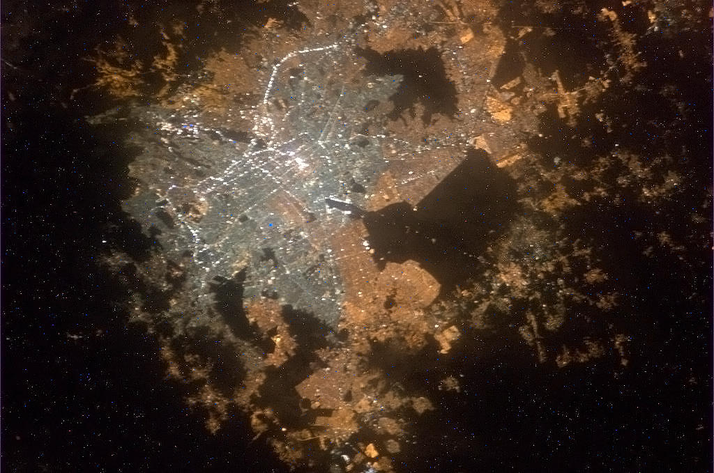
On the Day of the Dead, it takes about 3 hours and a half to get from downtown Mexico City to Mixquic, on its sotuheastern tip, bacause of the ingoing traffic.
0 Replies
 
fbaezer
 
  2  
Reply Thu 7 Feb, 2013 06:24 pm
Other images of Mixquic:

http://www.eluniversal.com.mx/img/2010/10/Cul/diosaMixquic.jpg

http://reydocbici.com/blog/wp-content/uploads/2010/11/am01.jpg

This channel takes you to Xochimilco, another borough-

http://vecinos.ciudadanosenred.com.mx/juancarlos/files/2009/10/Mixquic2-300x181.jpg
0 Replies
 
fbaezer
 
  1  
Reply Thu 7 Feb, 2013 06:31 pm
My daughter went to one of UNAM's high schools, CCH Sur, situated next to the University's main campus, at Mexico City's south.

She lives a bit west of downtown, and made a 50 minute ride, at 6:10 a.m (by subway and bus) to make it to school.
A schoolmate friend of hers, with the apt Náhuatl last name of Xocotoxtle, lives in Mixquic, at the southeast end of the city. The kid had to wake up at 4:30 a.m, and leave his house at 5:20 in order to arrive on time.
Xocotoxtle had no computer at home, so he had to go to an Internet-cafe in his town to make most of his homeworks. But he did finish with decent grades and studies now chemistry (I think).

One of the great things about UNAM is that students with such different backgrounds get to know each other, work together and befriend.
0 Replies
 
Ceili
 
  2  
Reply Fri 8 Feb, 2013 12:17 am
@fbaezer,
The farm or fields in the centre of volcano in Tláhuac, are they owned by one family or many? I'm just amazed people would live there. I think I'd be terrified on a pretty regular basis. I know it's extinct and all, but jeepers, it's the idea of it...
fbaezer
 
  1  
Reply Fri 8 Feb, 2013 10:18 am
@Ceili,
It's an ejido, a colective form of posession of arable land.
By the way, there's a vulcano just like Xico in Hawaii, with a city around it.

Very good question, I had never thought about that.
cicerone imposter
 
  2  
Reply Fri 8 Feb, 2013 06:00 pm
@fbaezer,
Diamon Head with Honolulu (Waikiki) that surrounds it - more or less.
fbaezer
 
  1  
Reply Fri 8 Feb, 2013 07:54 pm
@cicerone imposter,
Yes, and it's the same type of vulcano.
Ceili
 
  1  
Reply Fri 8 Feb, 2013 09:05 pm
@fbaezer,
Do people live in the crater in Hawaii?
 

Related Topics

20 Years Ago: Our Earthquake - Discussion by fbaezer
Mexico City approves gay marriage - Discussion by ossobuco
 
  1. Forums
  2. » Mexico City
  3. » Page 25
Copyright © 2024 MadLab, LLC :: Terms of Service :: Privacy Policy :: Page generated in 0.03 seconds on 04/28/2024 at 12:54:37