Reply Wed 8 Aug, 2012 11:01 am
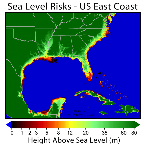
So if the Greenland ice sheath goes away and the sea level rises 23 ft. globally as a result... I realize these are arbitrary figures... in this scenario... how much of the coast of NC disappears and how far inland? Would Raleigh for instance, 120 miles in... become wetlands or beachfront property or neither? All speculative I realize, but I'm interested, and interested in the method used to calculate these things. Thanks.
  • Topic Stats
  • Top Replies
  • Link to this Topic
Type: Question • Score: 1 • Views: 3,135 • Replies: 2
No top replies

 
rosborne979
 
  1  
Reply Wed 8 Aug, 2012 01:42 pm
@blueveinedthrobber,
This is a storm surge map for a similar area, but maybe it'll give you some idea.

http://www.thempc.org/documents/Transportation/WaveEcology/Data%20and%20Analysis/Disaster%20Potentials%20-%20Flooding%20and%20Sea%20Level%20Rise/2009%20StormSurge%20Map.jpg
0 Replies
 
rosborne979
 
  1  
Reply Wed 8 Aug, 2012 01:51 pm
@blueveinedthrobber,
I like this one. Looks like the Bahamas are toast.

http://ete.cet.edu/gcc/style/images/uploads/Sea%20level%20risk-East%20Coast.png
0 Replies


Related Topics

 
  1. Forums
  2. » Hey Farmerman
Copyright © 2024 MadLab, LLC :: Terms of Service :: Privacy Policy :: Page generated in 0.15 seconds on 04/23/2024 at 10:46:03