13
   

OUTRAGE OVER WHALING ... #2 <cont>


High Seas
 
  1  
Reply Sat 6 Mar, 2010 07:20 pm
@msolga,
Just reported both duplicate posts giving this explanation for error - hope they will be removed a.s.a.p. Sorry again.
Quote:
erroneous duplicate post of mine - kindly remove if at all possible. thank you.
msolga
 
  1  
Reply Sat 6 Mar, 2010 07:26 pm
@High Seas,
I don't think the moderators actually do that, High Seas.
Please don't worry yourself about it. Anyone reading this thread will realize they're accidental duplicate posts.
farmerman
 
  1  
Reply Sat 6 Mar, 2010 07:54 pm
@msolga,
JL has some glitch in his puter so he double posts all the time.
msolga
 
  1  
Reply Sat 6 Mar, 2010 08:01 pm
@farmerman,
Ah. It might be starting to happen again, then, farmer. This used to happen quite often, didn't it, a few versions of A2K back?
0 Replies
 
msolga
 
  3  
Reply Sat 6 Mar, 2010 08:56 pm
@High Seas,
The multiple posts have now been removed, at High Seas' request.
Thank you very much, dear moderators! Smile
High Seas
 
  1  
Reply Sun 7 Mar, 2010 06:50 am
@msolga,
It's sometimes difficult to calculate greater circle distances on maps, so anyone without navigation calculators can download a free one here:
http://demonstrations.wolfram.com/GreatCirclesOnMercatorsChart/HTMLImages/index.en/thumbnail_1.gif
http://demonstrations.wolfram.com/GreatCirclesOnMercatorsChart/
The red line between any 2 anchor points is the shortest distance between the points - doesn't always look right on a flat map, but it works. You can use the demo version on the link, or, for the live version - where you can move the arrival and destination anchor points - you can download the (freeware) Mathematica 7 program from the same link. The program displays both shortest route (red line) and distance (in statute miles).

For polar regions standard maps don't work well, so use this link instead to compare loxodromes (straight lines on the flat map) with shortest routes (greater circle distances) : http://demonstrations.wolfram.com/ComparingLoxodromesAndGreatCircleRoutes/
georgeob1
 
  1  
Reply Sun 7 Mar, 2010 06:54 am
@High Seas,
I do enjoy these lubberly discoveries about navigation and oceanic routings.

It's still a very long way from Perth to Reecife (or Belem). Most ships would travel a bit north of the great circle route under the Cape to avoid the "Roaring 40s" (= very stormy latitudes).
farmerman
 
  1  
Reply Sun 7 Mar, 2010 06:59 am
@georgeob1,
I always plot a great circle route from Eatport Me to the Sable Islands. We used to plot long distances on a "Schmidt or Wulf net" which were used primarily for fracture analyses. Youd plot coordinates (via Loran) on the Net and then select points between and solve for their coordinates and then stick them in as way stations on the Loran. That was a total pain in the ass for a short trip. I understand they still use Loran in some places

Now, even cheap GPS's give you the polar geometry solutions without even picking up a pencil.
0 Replies
 
High Seas
 
  1  
Reply Sun 7 Mar, 2010 07:21 am
@georgeob1,
Lubberly they are - but consider that if ever electronics become unavailable for any reason (best not to think about it) most people who went to school after we did would be totally helpless. I originally learned navigation the very-very-old-fashioned way - equipped with only a table of logarithms and a blank sheet of paper where all the calculations had to be made manually and handed to the teacher along with the exam paper. It sounds like Cro Magnon, and probably was. Anyway consider not all posters here are as sophisticated as you and Farmerman, so for them calculators may be useful.
High Seas
 
  1  
Reply Sun 7 Mar, 2010 07:38 am
@High Seas,
OK have to run, but here's the elegant version of my last paragraph Smile
http://www.cartoonbank.com/2003/And-then-one-day-the-grid-went-down-and-never-came-back-up/invt/126576
http://cdn.cartoonbank.com/content/ebiz/cartoonbank/invt/126576/126576_s.jpg
"And then one day the grid went down and never came back up."
0 Replies
 
georgeob1
 
  1  
Reply Sun 7 Mar, 2010 07:53 am
Well, it was more than I could resist. I didn't mean to be snide.

Farmerman is right about the transformation brought about by GPS. It's all easy now.

Sable island, as I recall, is off the Nova Scotia coast due north of Bermuda. I once on a dare tried to find it in an A-4 (small, single seat, delta wing aircraft) during carrier ops a few hundred miles north of Bermuda. We had only a compass and a TACAN (useful only for finding the ship) for navigation, so it was mostly DR navigation & eyeball (while not watching the fuel gauge). Wasn't much to the place, just a sandy crescent-shaped islet close to the continental shelf.
farmerman
 
  1  
Reply Sun 7 Mar, 2010 10:26 am
@georgeob1,
For a boat, Sable ISland is a convenient turning point to steer to Ft Louisburg and inland to Ionia in the Bras d'Or , and if the seas arent "angry", its a beautiful morning sunrise ride.

Quote:
I once on a dare tried to find it in an A-4 (small, single seat, delta wing aircraft) during carrier ops a few hundred miles north of Bermuda
Wht? no instructions for flying "the Triangle"? Aint it amazing how we make things up just to scare our kids. Ill bet that, in any given day more planes and craft are plying the Triangle proper without incident.
georgeob1
 
  2  
Reply Sun 7 Mar, 2010 11:18 am
@farmerman,
Agreed. Unfortunately there are always unscrupulous purveyors of misleading statistic ready to serve the legions of eager, credulous consumers.

However, try telling them that nuclear power is cheaper (by far) than wind or solar power.
farmerman
 
  1  
Reply Sun 7 Mar, 2010 12:23 pm
@georgeob1,
Thats your job. Im busy tryin to squeeze out more oil and titanium.
0 Replies
 
msolga
 
  1  
Reply Sun 7 Mar, 2010 05:38 pm
Interesting discussion, you guys.
I know we'll get back to whales eventually. Smile Wink
0 Replies
 
msolga
 
  1  
Reply Sun 7 Mar, 2010 09:46 pm
News video from today's Sydney Morning Herald:

Sea Shepherd returns home:
http://media.smh.com.au/national/national-news/sea-shepherd-returns-home-1200045.html
georgeob1
 
  2  
Reply Mon 8 Mar, 2010 10:00 am
@msolga,
I watched the clip. I noted that the Ausrtralian Senator (Green Party) refered to "Australia's Arctic Waters". Interesting, but as I expected. Perhaps someone could tell him that these aren't Australia's national territory.

On the other hand he could vote for a declaration of was against Japan.
High Seas
 
  1  
Reply Mon 8 Mar, 2010 12:57 pm
@georgeob1,
The minister obviously mis-spoke - he meant Australia's 
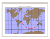
Antarctic waters. They do have a 200-mile EEZ (economic zone) in the waters around the Australian Antarctic Territory, and the USGS depends on them for monitoring the vast territory of Eastern Antarctica.
Quote:
26 February 2010
A massive iceberg, measuring 78 kilometres long and 39 kilometres wide, has calved from the Mertz Glacier in the Australian Antarctic Territory......

http://www.aad.gov.au/default.asp?casid=37551

Btw, Ms Olga, the posts here with information on maps, sea lanes, energy and other natural resources, are in no way a digression on your topic. They are of vital importance for whales and dolphins: you recall they need to migrate to summer / winter fishing grounds, and must accordingly take their chances with ships, drilling platforms, other man-made obstructions in addition to Japanese and Norwegian whalers.

Even political and military issues are relevant to the survival of the several species of endangered cetaceans - the Falklands being only the latest blip on that screen (see also link on Mrs Clinton on previous page, and btw I'm in London now and her statement is highly criticized front-page news):
http://media.economist.com/images/20100220/201008AMM949.gif
http://www.economist.com/world/americas/displaystory.cfm?story_id=15546482
High Seas
 
  1  
Reply Mon 8 Mar, 2010 01:12 pm
@High Seas,
PS I just listened to the recording: the minister really did use the correct Australia's "Antarctic" waters - it's a bad quality link, but clear enough.
0 Replies
 
msolga
 
  2  
Reply Mon 8 Mar, 2010 01:42 pm
@georgeob1,
Do, it was definitely "Antarctic", George.
Perhaps it's the Australian accent?
That was Bob Brown, leader of the Australian Greens & sitting member of the upper house of the federal parliament.
 

Related Topics

 
Copyright © 2024 MadLab, LLC :: Terms of Service :: Privacy Policy :: Page generated in 0.03 seconds on 05/05/2024 at 07:33:27