1
   

Star Maps


Quincy
 
Reply Fri 20 Apr, 2007 09:25 am
I had to draw two star maps for my Astronomy class. They were only meant to be rough maps. I would like to know:

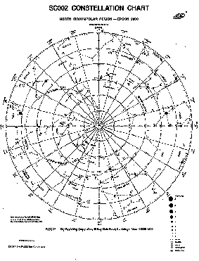
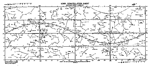
If you were to draw a star map showing Right Ascension and Declination (I have yet to actually see a star map that does show them), would the lines of Right Ascension and Declination appear on the star maps as arc's of circles, ellipses or something else?

I took an educated guess and said they would appear as arc's of circles, and then I used elementary trigonometry and co-ordinate geometry to draw the lines. The stand-in lecturer told me I didn't need that much accuracy, and did not know how the lines would appear, but said they would probably be ellipses. At the present moment I can not recall what my line of reasoning was, but I had reasoned, somehow, that they would be circle's. It must be taken into consideration I had this epiphanic moment late at night with a caffeine buzz...

I guess the question amounts to this (if you're not familiar with star maps):

Consider a hemisphere with staight lines between any two points drawn on its surface. If the hemi-sphere was translucent, if the lines were viewed from a perspective they would appear to be semi-circle. I dont think I'm making much sense... but its like the lines of latitude and longitude on a globe of the earth. If these lines were projected (say, by an incident ray of light perpendicular to the base of the hemi-sphere) onto the base of the hemi-sphere, how would those lines appear as projected? Arcs of circles, ellipses or something else?

I know this is very badly worded, I am sorry, I dont know how else to say it, and I cant find an appropriate image. Please help me, thank-you.

http://www.physics.csbsju.edu/astro/CS/images/CS.dec2.t.gif
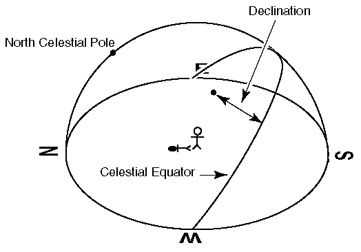
If the line streching from E to W was projected onto the surface the man is standing on, such that looking at the surface from underneath would be the same as looking at the line on the hemi-sphere from on the surface, how would the line appear on the surface?
  • Topic Stats
  • Top Replies
  • Link to this Topic
Type: Discussion • Score: 1 • Views: 15,652 • Replies: 11
No top replies

 
stuh505
 
  1  
Reply Fri 20 Apr, 2007 08:32 pm
Here is a star map:

http://csep10.phys.utk.edu/astr161/lect/time/starmap-large.gif

Note that the map shows the Celestial Equator (which is the line traced by the projection of the Earth's equator onto the imaginary sphere surrounding the Earth) on it. Since declination is measured from the celestial equator, this star map actually IS showing some information about declination. All stars on that line have declination = 0.

Here is a diagram I made to show the equatorial coordinate system. The gray plane is the equatorial plane. The celestial poles can be seen extending from the Earth's poles. The white lines on the imaginary sphere show the angles of declination (horizontal lines) and right ascension (vertical lines).

http://img171.imageshack.us/img171/1669/equatorialst4.jpg

I don't know much about star maps, but this star map is circular and shows the equatorial plane bowing down, indicating that the celestial sphere is being viewed from the outside. Therefore, the rest of the lines would look like this:

http://img171.imageshack.us/img171/1032/equator22qm8.jpg
0 Replies
 
Quincy
 
  1  
Reply Sat 21 Apr, 2007 04:56 am
With regards to the last image, star maps are meant to represent the celestial sphere as viewed from inside, therefore North would be at the top, and you would be able to see the north celestial pole and some lines of declination forming rings around it, not quite as you have it. You still haven't told me how the lines would appear on the star maps.

For those who don't know much about star maps:
http://www.physics.csbsju.edu/astro/
And start with the "Spherical Astronomy Terms" tutorial.
0 Replies
 
stuh505
 
  1  
Reply Sat 21 Apr, 2007 09:52 am
Quote:
With regards to the last image, star maps are meant to represent the celestial sphere as viewed from inside, therefore North would be at the top, and you would be able to see the north celestial pole and some lines of declination forming rings around it, not quite as you have it. You still haven't told me how the lines would appear on the star maps.


Well, I'm not an astronomer, but...if is a picture from the inside, just invert the 3d image I showed before. Should be easy enough to do in your head. But that doesn't mean it is pointing directly at one of the celestial poles. This star map obviously isn't pointing at one of the poles because you can see the celestial equator in it. So the lines of declination and right ascension are going to be curves just the same as if it were shot from the outside in. If you're looking at one of the poles then right ascension lines would look like rays coming out from the center and declination lines would look like concentric circles. If the map had a smaller field of view then it would look like a slightly distorted grid. In all cases you are looking at circles or pieces of circles being projected, which means the lines can appear as either circles, curves, or approximately straight lines. Every one of the star maps on this website shows some of these lines for reference.
0 Replies
 
Quincy
 
  1  
Reply Sat 21 Apr, 2007 12:24 pm
Meh, I dont understand what your going on about in your reply, maybe you didnt understand my reply.

What I meant about the last image is that if the celestial equator appears to be "bowing" then you must have given the star map for some place in the northern heimsphere on earth, so it should see the celestial pole on that map
http://www.physics.csbsju.edu/astro/CS/images/CS.dec2.t.gif

As you can see here the north celestial pole appears above the horizon, so it will be projected staight onto the surface the little stick man is standing on, with concentric rings appearing around it, up to
declination = latitude of viewing position on earth

Quote:
In all cases you are looking at circles or pieces of circles being projected, which means the lines can appear as either circles, curves, or approximately straight lines.

Are you telling me that the lines of Declination and Right Ascension would appear as arcs of circles OR some other type of curve?

Quote:
Every one of the star maps on this website shows some of these lines for reference.

Able2know.com has star maps?
0 Replies
 
stuh505
 
  1  
Reply Sat 21 Apr, 2007 12:41 pm
Quincy wrote:
What I meant about the last image is that if the celestial equator appears to be "bowing" then you must have given the star map for some place in the northern heimsphere on earth, so it should see the celestial pole on that map


No, because the celestial equator is a full 90 degrees off from the celestial pole, so my point is that if the celestial equator appears at all in the star map, and the field of view is obviously less than 90 degrees, then the celestial pole could not be in the map.

The celestial equator will always appear as a bowing curve unless you are looking directly at it, in which case it would look like a straight line...but in reality it would still be a curve.

Quote:
Are you telling me that the lines of Declination and Right Ascension would appear as arcs of circles OR some other type of curve?


No, I'm saying that lines of right ascension would always look like incomplete arcs of ellipses. Arcs of declination would also be arcs of ellipses but it would be possible to have complete ellipses, but unlike right ascension the arcs could be complete ellipses and could have zero eccentricity (eg, circles) if you were looking directly at a pole.

Quote:
Every one of the star maps on this website shows some of these lines for reference.


No, I was referring to the link you gave.

http://www.physics.csbsju.edu/astro/SC2/images/sc2.gif

In this diagram the concentric circles are lines of declination and the straight lines coming out from the center are lines of right ascension. In this case they appear to be circles and straight lines but that is only a special case of arcs of ellipses which they could be if the map was of a different location.

http://www.physics.csbsju.edu/astro/SC1/images/sc1.gif

This map is completely different, it is a cylindrical projection, and it also shows the lines of declination (the horizontal grid lines) and right ascension (the vertical grid lines). They will always be straight lines in this map, but it is distorted because in reality the straight lines at the top and bottom should all be converging to the poles...since it is distorted here, that is why they usually provide separate circular pictures for the area around the poles (shown in the first link).
0 Replies
 
Quincy
 
  1  
Reply Sat 21 Apr, 2007 01:24 pm
Quote:
No, because the celestial equator is a full 90 degrees off from the celestial pole, so my point is that if the celestial equator appears at all in the star map, and the field of view is obviously less than 90 degrees, then the celestial pole could not be in the map.


No, and I am VERY certain of this. A star map shows half of a sphere, i.e. what you should be able to see from any point on the earths surface, that is, 180 degrees in all directions. I know this because my professor has drawn star maps during class, and if the star maps are for any latitude on earth that is NOT the equator, then you WILL be able to see the appropriate celestial pole on the star map.

Quote:
No, I'm saying that lines of right ascension would always look like incomplete arcs of ellipses. Arcs of declination would also be arcs of ellipses but it would be possible to have complete ellipses, but unlike right ascension the arcs could be complete ellipses and could have zero eccentricity (eg, circles) if you were looking directly at a pole.


So, taken that the star map is not for the earths poles, all the lines would be arcs of ellipses? Im sorry I cant just take your word for it, why is this so?
0 Replies
 
stuh505
 
  1  
Reply Sat 21 Apr, 2007 02:25 pm
Quote:
No, and I am VERY certain of this. A star map shows half of a sphere, i.e. what you should be able to see from any point on the earths surface, that is, 180 degrees in all directions.


Ah, ok. I was just assuming a smaller FOV. But that doesn't change anything about what I've been saying.

Quote:
So, taken that the star map is not for the earths poles, all the lines would be arcs of ellipses? Im sorry I cant just take your word for it, why is this so?


Well, yeah. I mean they couldn't possibly all be arcs of circles because the lines are circles in 3D space and when you look at a circle from any other angle it is an ellipse. And it's not a complete ellipse because part of it gets cut off on the image. So yes every single line will be an arc of an ellipse.

Now that you have told me the proper FOV, I am able to generate what the star map would look like if you were looking directly at the celestial equator, halfway between the equator and the pole, and then also at the pole. I made the equator look red.

http://img239.imageshack.us/img239/5553/starmapsanglesab1.jpg

Then just to prove it's correct, I generated a star map looking at the equator and overlayed the lines onto it. If you look closely you will see in the generated map 2 X's that correspond to the poles which are at the same location in my image. You will also see that the equator matches up. Finally you can see that the constellation regions are bounded by "boxy" regions, and the sides of these boxes are in synch with all the grid lines I projected.

http://img239.imageshack.us/img239/678/overlayjz5.jpg
0 Replies
 
Quincy
 
  1  
Reply Sat 21 Apr, 2007 02:34 pm
Ah, thank you very much stuh505, I can now see why they are arcs of ellipses.

By the way, how did you generate those images? And what time of year is it meant to be for the last image?

But thank you again.
0 Replies
 
stuh505
 
  1  
Reply Sat 21 Apr, 2007 03:20 pm
Thank you too Quincy, for making me learn something about the equatorial coordinate system Cool

Sky above 0°N 0°W at Sat 2007 Apr 21 21:19 UTC

You can generate them here:
http://www.fourmilab.ch/cgi-bin/Yoursky
0 Replies
 
g day
 
  1  
Reply Sat 21 Apr, 2007 07:32 pm
Personally Meridans, Celestial equator, Eclipitic etc are things I wish to forget rather then remember - and I'm an amateur astronomer. I'd much rather the Goto in my mount to abstract all this for me so I can just run a program Cartes Du Ciel map the night sky (then using ASCOM drivers) let it drive my scopes around.
0 Replies
 
stuh505
 
  1  
Reply Sat 21 Apr, 2007 08:51 pm
g__day wrote:
Personally Meridans, Celestial equator, Eclipitic etc are things I wish to forget rather then remember - and I'm an amateur astronomer. I'd much rather the Goto in my mount to abstract all this for me so I can just run a program Cartes Du Ciel map the night sky (then using ASCOM drivers) let it drive my scopes around.


I know what you mean. I care about the physical facts of space, not arbitrary geocentric metrics! But it is still nice to be able to understand information when it is presented in this other language, so to speak. My step father uses a similar setup in his observatory.
0 Replies


Related Topics

Evolution 101 - Discussion by gungasnake
Typing Equations on a PC - Discussion by Brandon9000
The Future of Artificial Intelligence - Discussion by Brandon9000
The well known Mind vs Brain. - Discussion by crayon851
Scientists Offer Proof of 'Dark Matter' - Discussion by oralloy
Blue Saturn - Discussion by oralloy
Bald Eagle-DDT Myth Still Flying High - Discussion by gungasnake
DDT: A Weapon of Mass Survival - Discussion by gungasnake
 
  1. Forums
  2. » Star Maps
Copyright © 2024 MadLab, LLC :: Terms of Service :: Privacy Policy :: Page generated in 0.04 seconds on 04/30/2024 at 06:14:10