2
   

Questions on the Dimensions and Positions of Continents


Reply Fri 19 Jul, 2013 10:48 am
I am trying to come up with a supercontinent to use as a setting for a story, but I'm having trouble visualizing the details of how the continents would look as they move across the surface of a sphere. In general, I need someone who either has a deep understanding of the continents or a 3D modeling program that can position the continents on a 3D surface to help me map out my idea, but there is one specific question that is bugging me in particular.

The supercontinent is based on the Amasia model seen in this image, with Antarctica remaining isolated and closure of the Pacific, but there are some key differences. The biggest of these is that instead of colliding with the Bering Strait, Australia changes course and closes up Wallacea, connecting with the Sunda Shelf. As South America moves west and rotates, the Southern Cone (now a Western Cone) meets with Australia on the other side. The result is that the Pacific Ocean does not vanish completely; it "closes" in the sense that it becomes an entirely landlocked ocean, but still remains as a sizable body of water, an "Inner Ocean" as I call it.

The issue I'm having is that I can't quite determine the size of this "Inner Ocean". One of the features of this ocean is a continent called "Amuria" that breaks off from Asia (an extrapolation of rifting in Siberia that is responsible for the formation of modern-day Lake Baikal). When using the map linked above as a rough guide, the Inner Ocean appears to be big enough to comfortably house such a continent inside of it. However, when I tried to simulate the positions of the continents myself (using paper cut-out continents traced from a Dymaxion Map), every configuration I came up with resulted in an Inner Ocean that was far too cramped.

So how big would the Inner Ocean actually be? Would having an ocean inside of a supercontinent with a smaller continent inside of it like some kind of geographic Matryoshka Doll be possible, or would Amuria wind up crashing into North America long before South America could connect to Australia?
  • Topic Stats
  • Top Replies
  • Link to this Topic
Type: Question • Score: 2 • Views: 2,684 • Replies: 12
No top replies

 
rosborne979
 
  1  
Reply Fri 19 Jul, 2013 11:05 am
@XionGaTaosenai,
There are going to be numerous models with future predictions, but some of them are here:

http://www.youtube.com/watch?v=VQHyy2C7dDg

http://www.youtube.com/watch?v=IK24bOKEfj8

http://www.npr.org/2012/02/08/146572456/amasia-the-next-supercontinent

There are also some tools you might use here: http://www.scotese.com
rosborne979
 
  1  
Reply Fri 19 Jul, 2013 11:17 am
@XionGaTaosenai,
Amasia model1

Movie2
0 Replies
 
XionGaTaosenai
 
  1  
Reply Fri 19 Jul, 2013 12:35 pm
@rosborne979,
I've seen all of that already. There are numerous models for future continent arrangements, of which the most popular are Novopangaea (Closure of the Pacific, Antarctica joins), Amasia (Closure of the Pacific, Antarctica does not join), and Pangaea Proxima (Closure of the Atlantic).

I'm not asking how the continents will arrange themselves in the future; I've researched that extensively already. The truth is that you can't make one true prediction over such a timescale. It's like watching a random car moving down a highway and trying to predict where it will go. You have a good idea where it will be 5 minutes from now, but you don't know where it's destination is, what direction it will go when it meets a fork in the road, or when it will get off the highway, so predicting where the car will be in an hour is next to impossible. In the same way, we have a good idea of where the continents will go in the next 5-10 million years, but over 100-200 million years and beyond, we can only make a broad list of where the continents could be after such a timeframe, and we have no way of proving one possibility over another. What this means for an author who wants to write a story over such a timeframe is that they can look at all of the myriad possibilities and cherry-pick whichever one they like the most.

I have a good idea of what I'm envisioning, but I need some help from someone who has a better grasp of the geometry involved.
rosborne979
 
  1  
Reply Fri 19 Jul, 2013 02:26 pm
@XionGaTaosenai,
You seem to recognize that you cannot accurately predict continental arrangements over such a large time frame, but you also seem to be asking for a modeling program that can make just such a prediction. So I'm confused by what you are actually seeking.

Why do you need such precision to write a fiction story? Can't you just define the environment to fit the story you want to tell? Nobody will be around in 200million years to know if your story is accurate or not.
XionGaTaosenai
 
  1  
Reply Fri 19 Jul, 2013 04:38 pm
@rosborne979,
The basic synopsis of the setting is that it centers around a post-human civilization that has reached the level of technology we had in the 16-17th century, with a similar drive for exploration. It's basically a speculative documentary similar to the Future is Wild, except instead of skimming over the world and life of 3 eras, it explores one era in detail, and places the scientific documentary fare alongside stories of the exploits of what would be a new species equivalent to our Marco Polos, Christopher Columbuses, and Ferdinand Magellans. So it's not a setting that is just "the future, and that's all you need to know"; the geography and life of the future planet is going to be explored in excruciating detail, because said exploration is the entire plot.

This is the kind of stuff that lends itself naturally to showing your work, and I intend to do a lot of that. I intend to eventually have a map that includes the climate in every area of the planet in detail going as far as to chronicle the locations and paths of any and all notable rivers, with a record of what the climate would have been like for the past 5 million years so that I can keep track of where the species of this post-human civilization would have first evolved (they aren't human, and probably aren't even mammals, but they should have a similar ability to run, climb, swim, and wield tools, and that kind of mobile diversity tends to evolve in environments that were previously heavily forested but dried up geologically recently, forcing a previously arboreal species to quickly adapt to life on the ground), as well as where they would spread where they would discover agriculture and build cities (and what kind of plants and animals they would domesticate). There's a rich tapestry of world-building to be woven here, and I don't want it to be marred by continents that are out of proportion to each other.

I'm not asking for a modeling program to make a prediction for me, I just need someone more spatially aware than I to help make sure my map doesn't wind up distorted.
rosborne979
 
  1  
Reply Fri 19 Jul, 2013 05:53 pm
@XionGaTaosenai,
XionGaTaosenai wrote:
I'm not asking for a modeling program to make a prediction for me, I just need someone more spatially aware than I to help make sure my map doesn't wind up distorted.

I'm not sure such a person exists. Even experts are going to have their own ideas about how a model should work and where it will end up.

Actually it sounds like you pretty much have your own model in mind and just want some other professional at computer modeling for plate tectonics to validate that your model isn't too much out of line. That type of expertise is probably limited to academic institutions and professors, and even then you're likely to get a different prediction from everyone, especially at the time frames you're looking for.
XionGaTaosenai
 
  1  
Reply Fri 19 Jul, 2013 06:19 pm
@rosborne979,
Yes, that was exactly what I was looking for; someone to help make sure information is at least plausible, and correct obvious errors/stop them before they start.

The specific problem I'm trying to solve here is that any visualization I make of the continents is based on 2D representations of a 3D space, which leads to distortion and muddies the waters from a geometric perspective. All I need - at this stage, at least - is someone who has a better grasp of spherical/spheroid geometry to give me some input that can't be obtained from a 2D map.

I probably need the help of some kind of expert, or at least a student majoring in the relevant field, but I don't know where to contact such a person. I stumbled on this site by accident while trying to find a good forum on geology, and it seems to me like the idea is to ask a question where an expert can find it, so that is what I did.
farmerman
 
  2  
Reply Fri 19 Jul, 2013 06:56 pm
@XionGaTaosenai,
there were several "supercontinental" masses. Columbia, Rhodinia, Panggea (and its sub segments). Remember that the "plumes of mantle upwelling also migrate and this is associated with the ultimate plate movement.
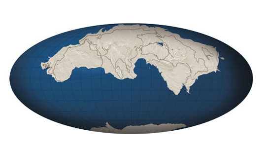
Start with the old ocean (the Panthalassian Sea) and reconstruct how PAnge assembled itself. Ive seen several "models' as a field geologist. (We use these reconstructions to define possible "Suture" locations in which hydrothermal; deposits and fumarolic deposits of elements are concentrated possibly.
Still, the Best SOurce is the 2001 book "Continents and SUpercontinents" by Rodgers and Santosh(Oxford Press). Its written for structural geologists but is fairly easily read if you have a decent introduction to Physical Geology.

WRiting a book (Im assuming its a scifi) you can almost justify any configuration, like, for example. We know that the Afar triangle of the Horn of Africa will be a suture of separation that will make Africa unconnected once again. I think the most important concept for a scifi book will be the effect on CLIMATE .We know that during the Cryogenian Period, the circulation of ocean currents was so directed that the circumpolar "Strreams" had no strength to warm the mid latitudes. Also , during pre breakup of Pangea, we know that the huge landmass was substantially arid with monsoons and large deltaic discharge areas)
You don't really need to look at this as a spherical geometry problem, You can look at a map of the landmasses and anayze the circular pattern of a landmasses drift. Like Inida slammed into the belly of Asia from a center of
circulation" that was to the present SW. From an evaluation of orogenic belts and these patterns of suture, you will see that the planet has been so sliced and diced that projecting it to the near future is possible. Projecting it to , say 130 MM years, will be less accurate.

I think you should concentrate on the story and let science take its own course. Youll find that todays "scientific truth" will be debunked tomorrow.

Why not use the old theory of "Geosynclinal troughs" be the source of your landmasses. That would be moe originl to dispute present thought. Theres plenty of sci fi authors who poo poo almost everything that science has discovered(or else they relate these findings to extra terrestrial sources)
XionGaTaosenai
 
  1  
Reply Fri 19 Jul, 2013 07:14 pm
@farmerman,
It's less science fiction-y than you'd think. It's more of a revival of 18th century literature revolving around romanticized explorers and the thrill of adventuring the globe, with an exotic coat of paint placed on it (though you might argue that much science fiction is the same). Exploration on the high seas is a genre that literally has no new ground to tread since the world has been explored, and while science fiction uses the same tropes while replacing the Earth with the Galaxy to maintain the mystique, this setting takes advantage of the fact that if you turn the clock forward enough, the Earth will change so much that is basically "un-explores" itself. Add in a new species developing technology and civilization on its own, and the world of sails and scurvy, of caravans to unknown lands, can be reborn!

A lot of the things you are trying to help me with I have already handled (I have already done months of research on my own before this). All I'm really asking for is someone to draw a map for me, because I don't trust myself to do it without distorting the sizes and shapes of the landmasses too much.
farmerman
 
  1  
Reply Fri 19 Jul, 2013 07:24 pm
@XionGaTaosenai,
Well, its summertime over here .MAny geology students are at field camp and are now dealing with trend surfaces and such things as you wish. Im sorry but its really not my area of interest (I actually look at sutures in retrospect an evaluate resource deposits based upon global tectonics) SO present (forward looking) dysnamics only leaves me with a big excess of sulfur and sulfosalt minerals(Not a lot of use)

I hope to read your book sometime, Im always interested in reading literature that is scientifically based (like the science in Jules Verne or Ray Bradbury, we know their speculations often had some real value)
0 Replies
 
rosborne979
 
  1  
Reply Fri 19 Jul, 2013 07:36 pm
@XionGaTaosenai,
XionGaTaosenai wrote:
I probably need the help of some kind of expert, or at least a student majoring in the relevant field, but I don't know where to contact such a person. I stumbled on this site by accident while trying to find a good forum on geology, and it seems to me like the idea is to ask a question where an expert can find it, so that is what I did.

I don't think we have an expert of that nature here presently. However, you might want to try to contact this guy: http://people.earth.yale.edu/profile/ross-mitchell/about

He's the author of one of the articles cited above. Obviously he's going to prefer his own model over others, but if you prefer to work with a different model he might be able to refer you to any number of other researchers.

For pure geology, Farmerman is probably the closest thing we have to an expert here on A2K. There are a number of people online here who have a very good broad range knowledge of science (there are also a bunch of crackpots and you have to be able to recognize which is which), but what you are asking for is very specific and obscure so I don't think you'll find it without reaching out to the grad students who are focused on the problem.

Good luck,
0 Replies
 
cicerone imposter
 
  1  
Reply Fri 19 Jul, 2013 10:23 pm
@XionGaTaosenai,
I would only offer one suggestion. With the artic ice melting, the amount of land exposed today will look much different in a thousand - million years.

0 Replies


Related Topics

Where am I - Travel Game II. - Discussion by Walter Hinteler
So you think you know Europe? - Discussion by nimh
Palestinian People are Fake - Discussion by Advocate
Do you know the countries of Europe? - Question by pandybear
Test your Mid-East/North Africa geography - Discussion by Robert Gentel
Is Turkey in Europe or in Asia? - Discussion by Proteinn
Most Secure Place - Question by DannyMac3030
Desert Pavement Distribution - Question by jstn
most navigated river - Question by Jasmin Leclerc
Elevation change - Question by UltimateAloha
 
  1. Forums
  2. » Questions on the Dimensions and Positions of Continents
Copyright © 2024 MadLab, LLC :: Terms of Service :: Privacy Policy :: Page generated in 0.04 seconds on 04/18/2024 at 03:54:39