10
   

Mapmaking's "Best in Show"


Walter Hinteler
 
  2  
Reply Wed 4 Jan, 2012 01:56 pm
@georgeob1,
georgeob1 wrote:
Even today's charts are less accurate than the GPS locating tools we use to navigate.


That certainly depends on the scale you use.
Otherwise, one river mouth ...
http://i40.tinypic.com/o9e0dw.jpg
... might look like another one
http://i41.tinypic.com/ejbvxk.jpg

Wink

georgeob1
 
  2  
Reply Wed 4 Jan, 2012 02:43 pm
@Walter Hinteler,
Very true. And one coastal inlet can look very much like another one.

Once, during carrier ops in the North Sea, we were launched for some low level intrusion flights (part of a NATO exercise) about 100 NM off the Netherlands/German coast. My route called for a coast in point at an inlet near the town of Emden. Unknown to me the ship's electronic input to the aircraft inertial navigation system was off by about 40NM to the southwest. As I headed in to the lowering clouds with a heavy squall line & rainshowers paralleling the coastline, I could get only occasional and poor images of the coastline on the radar. At 450Kts and 200ft altitude under the low clouds and with poor visibility, things were moving and changing fast. Soon I began to pick out glimpses of coastline to the left and right - perhaps Emden was just ahead and slightly left as planned. However soon I began to see large channel markers in the water, and then several large ships went by: seconds later I could make out the outline of tall buildings , docks and a city about a mile ahead . I was in goddam downtown Bremerhaven! Nothing to do but jam the throttle and pull straight up into the clouds hoping nothing was there!

Happily no one noticed (or bothered to report) it, and I even got to my target on time.
Walter Hinteler
 
  2  
Reply Wed 4 Jan, 2012 03:42 pm
@georgeob1,
Quite funny that we talk about such: today, I got a dvd, on which someone copied some old 16mm films he made on the minesweeper I served on (in 1971 Embarrassed )

So, I mainly relied on this instrument ...
http://i39.tinypic.com/1eut13.jpg
... while the others were just there to confirm it (at least, in coastal areas, and the instrument on the left was mainly used to listen to music and football results)
http://i43.tinypic.com/25071w5.jpg
0 Replies
 
Setanta
 
  2  
Reply Wed 4 Jan, 2012 04:05 pm
Great thread, Boom . . .
Lustig Andrei
 
  2  
Reply Wed 4 Jan, 2012 05:28 pm
As one who has never used a GPS in a car (and steadfastly refuses to do so), I agree with Setanta 100 percent. Maps -- and, in particular, Geodetic Survey maps -- are not only indispensable when hiking (along w/a good lensiatic compass, of course) but provide a good deal of aesthetic pleasure as well. Woe be unto the human race should they ever become obsolete.
0 Replies
 
boomerang
 
  1  
Reply Wed 4 Jan, 2012 07:31 pm
@Setanta,
Thank you! I agree. I also fully acknowledge that it isn't anything I've done that made it great. I love it when a rather simple question attracts interesting people with a range of expertise and experience. The thanks really goes to you and the other respondents for sharing their own navigation stories.

I realize that my appreciation for maps and map making is really akin to the way I appreciate craftsmanship of anything..... I can recognize it as a beautiful thing but don't have any handle on how really important it is!

I've very much enjoying this reading.
0 Replies
 
boomerang
 
  1  
Reply Wed 4 Jan, 2012 08:12 pm
@Setanta,
Quote:
When i was a kid, i used to make my own maps, of imaginary places


Mo had a class assignment to make a map from a book that he had read. The assignment came with an example of a path laid out with blocks, with important bits of the story laid out in each block.

Mo made this, inserting flags and providing a key:

http://img.photobucket.com/albums/v667/boomerangagain/Panem.jpg

I thought it was beautiful!

When I visited the school and saw all of the other maps posted.... all laid in in blocks, with important events laid out in each block, I was sure that Mo had failed the assignment, that he'd missed some important instruction saying it had to be done in a certain way.

But he got an A on it!

And a note from the teacher telling him it was a beautiful map.
Lustig Andrei
 
  1  
Reply Wed 4 Jan, 2012 08:18 pm
@boomerang,
Teacher was right. It is a beautiful map. Smile
0 Replies
 
Linkat
 
  1  
Reply Thu 5 Jan, 2012 11:59 am
@boomerang,
Awww - I love school assignments like that - those that require thinking creatively. Usually these end up with great results and the kids really enjoy the project.
0 Replies
 
Butrflynet
 
  2  
Reply Thu 5 Jan, 2012 02:34 pm
Tomorrow is the 100th anniversary of New Mexico's statehood. The New Mexico History Museum has on display a series of maps that document the controversial history of New Mexico's borders and how it obtained the final shape.

Some of the maps from the 1500's to the 1930's can be seen on this site:

http://atlas.nmhum.org/

Quote:
Welcome to the New Mexico Humanities Council's online Atlas of Historic New Mexico maps. This website contains twenty historic maps of New Mexico, annotated with descriptions by the mapmakers and by other people living, working, and exploring in New Mexico at that time.

Click on the section titles or pictures on the left to learn more about the eras in which the maps were developed. Click on the map title or thumbnail to view the historic map in Google maps. Every map has more information than is immediately apparent. Zoom in fully to learn about each map in detail. Register (link in upper left) to share or save map views and to share map markers.


Lustig Andrei
 
  1  
Reply Thu 5 Jan, 2012 03:13 pm
@Butrflynet,
Fascinating stuff, butrflynet. Thank you forthe link.
0 Replies
 
ossobuco
 
  1  
Reply Thu 5 Jan, 2012 03:35 pm
@Butrflynet,
Thanks, Butrfly, I'll check that out.

I'm a map lover from way back; certainly in elementary school for some reason I don't really know, maybe that we moved around a lot when I was young. I just always liked them. Geography classes were my favorites and part of my liking history was for the maps. So why didn't I study geography later, dunno. We moved across the country for my first year in high school. The first I remember liking it at all was our having to draw a map of our own in world history class, and color it. (Were those my first colored pencils?)

I think the foundation of my craze for learning about Italy, good bad or indifferent about it, came from those early geography classes.

I've a friend who was an Los Angeles City cartographer, never visited him at work. But his holiday messages are always treasures - ink drawings of local flora, natives to varied west coast regions, much of which he explored on foot, and still does in his seventies.
0 Replies
 
Sturgis
 
  1  
Reply Thu 8 Mar, 2012 09:42 am
@boomerang,
I've always loved maps. When I was about 15 or so, I got an absolute treasure trove of them when our landlord died. He'd collected for almost all of his 90+ years of life and nobody else wanted them.

From the earliest days, I could be found with a map spread across the floor as I imagined all sorts of wonderful things, then headed to the bookshelf to learn about different cities and countries.

Atlases were another biggie for me. By the time I was through, they were all falling apart. My favorite was the railroad map atlas. I can still recall its dark brown cover, the yellowish paper the maps were printed on. A few times for my birthday my grandmother was kind enough to purchase an atlas for me. No ordinary atlas, she went out of her way to find only the most complete and up to date.

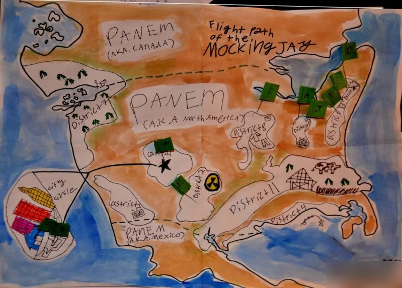
As time went on, I started creating maps. Sometimes on a blank sheet of paper, some in notebooks which had been meant for school assignments, and yes, even on the backside of some of those large maps from National Geographic. They had everything including schools, gas stations, shopping districts, government buildings, farmlands, and even the required prison. I always had the prison near the edge, right along the water. There were also bus routes, and in a number of them subway systems, including markings for where the stations were. A few had botanical gardens, and of course hospitals, houses of worship of dozens of denominations, including interdenominationals, there were parks, many were by the water and as the subways were put in, the dirt was used as landfill to expand the parks.


About the time the earlier mentioned landlord died, it was decided I'd found my life's calling (about the 200th calling). I would become a cartographer. Little did I know that that would mean actually using real pieces of land and water. The cartographer idea didn't last, I considered other vocations and eventually landed a nice gig in blacksmithing which I gave up for science (which in a way was the appeal of blacksmithing, seeing how metal changed with heat and discovering why). As far as I know, mother never recovered from my abandoning mapmaking.


I still use maps, I love them. Even when there's a map off the computer, I've been known to contact a friend and have them run a copy off for me (I don't have and don't want a printer with my computer). They are used less these days, obviously technology has made it easy to get information that can be carried around on different devices and cars have systems that do the job instead of the paper map. It's similar to actual books in paper being replaced by Nooks and Kindles as far as the changeover; however, like with books, there will always be those who prefer the feel of paper between the fingers.
boomerang
 
  1  
Reply Sat 31 Mar, 2012 10:41 am
Today I was reading about the mystery town "Argleton" which shows up only on Google maps:

http://i.telegraph.co.uk/multimedia/archive/01514/map_1514129c.jpg

The article talks about "street traps", fictional features that cartographers put into their maps to establish when someone has violated their copyright.

Interesting!

http://www.telegraph.co.uk/technology/google/6474746/Mystery-of-Argleton-the-Google-town-that-only-exists-online.html
0 Replies
 
Walter Hinteler
 
  1  
Reply Sat 31 Mar, 2012 10:54 am
@Sturgis,
There some two dozen remarkable maps created by children during the 19th century, in the blog of the David Rumsey Map Collection of map collector and cartographer David Rumsey.

Runsey's collection of old maps generally is one of the best - however, Old Maps Online, by The University of Portsmouth, UK and Klokan Technologies GmbH, Switzerland is the very best (search tool), because it's a portal.
farmerman
 
  1  
Reply Sat 31 Mar, 2012 02:28 pm
@Walter Hinteler,
just saw this thread.I have a set of the first survey topographic maps of the Grand Canyon. These were printed off in the late 1880s and I was able to purchase a set in the laste 1980s at an auction of maps .
If you want to get really knocked out, get a set of the Canadian Geological Surveys maps of the Canadian Shield done in the last 20 years. Or a geological map of the Blue Ridge mountain section of Virginia or North Carolina.
USGS publishes geological atlas folios at 1:62500 (roughly an inch of map distance is equivalent to a mile on the ground). These ATas folios have been produced to bring together the status of geological mapping up to that point. These were published beginning in the 1920's and the earliest ones were authored by a husband and wife team from Harvard and U of PEnnsylvania. The Appalachians, one of the least understood geo provinces , has some of the most coorful and detailed maps
0 Replies
 
boomerang
 
  1  
Reply Thu 20 Jun, 2013 08:35 am
Hey map lovers! Here's a great new map that shows the literal meaning of place names. I'm prepared to waste the day...

http://www.slate.com/articles/news_and_politics/map_of_the_week/2013/06/literal_meanings_of_places_in_the_u_s_map.html

Sample:

http://img.gawkerassets.com/img/18rc2lmcpqk5zjpg/ku-medium.jpg
0 Replies
 
Setanta
 
  1  
Reply Thu 20 Jun, 2013 09:22 am
There's a place name in Cumbria (northern England) which was long thought to mean Hill Hill Hill Hill--although that interpretation has been challenged. The place is Torpenhow Hill. "Tor" (Old English for hill), "pen" (British or Welsh for hill), "how" (Danish for hill)--with the modern English hill appended. There's another place in Merseyside which is called Torpen Howe.

Torpenhow Hill:

http://farm1.staticflickr.com/197/510554311_3606531a84_z.jpg
0 Replies


Related Topics

Create your own travel map - Discussion by nimh
So you think you know Europe? - Discussion by nimh
For the love of cartography?! - Discussion by tsarstepan
Google tracking your every move. - Discussion by maxdancona
Map with multiple scales - Question by duelly
Type and age of structure? - Question by ColonelCustard
 
Copyright © 2024 MadLab, LLC :: Terms of Service :: Privacy Policy :: Page generated in 0.03 seconds on 04/19/2024 at 08:41:15