30
   

Quake activity along the San Andreas fault is picking up


cicerone imposter
 
  1  
Reply Sun 29 Jun, 2014 03:53 pm
@Butrflynet,
Got an alert earlier today that we had a 3.2 earthquake near our town of Sunnyvale.
0 Replies
 
Butrflynet
 
  1  
Reply Fri 11 Jul, 2014 01:57 pm
JAPAN (KRON) — A tsunami advisory has been issued after a powerful earthquake was reported near Japan.
USGS Data on the Quake
Advisory from the Pacific Tsunami Warning Center
The magnitude 6.8 quake is centered about 185 miles east of Tokyo.
Stay tuned to KRON 4, the KRON 4 Mobile App, and KRON4.com for the latest on this developing story.

M6.8 - OFF THE EAST COAST OF HONSHU, JAPAN

Preliminary Earthquake Report
Magnitude 6.8
Date-Time
11 Jul 2014 19:22:00 UTC
12 Jul 2014 04:22:00 near epicenter
11 Jul 2014 13:22:00 standard time in your timezone
Location 37.069N 142.364E
Depth 13 km
Distances
129 km (79 mi) ESE of Namie, Japan
131 km (81 mi) E of Iwaki, Japan
147 km (91 mi) ENE of Kitaibaraki, Japan
151 km (93 mi) ENE of Takahagi, Japan
284 km (176 mi) ENE of Tokyo, Japan
0 Replies
 
Butrflynet
 
  1  
Reply Mon 21 Jul, 2014 09:46 am
M6.9 - FIJI REGION

Preliminary Earthquake Report
Magnitude 6.9
Date-Time
21 Jul 2014 14:54:40 UTC
21 Jul 2014 02:54:41 near epicenter
21 Jul 2014 08:54:40 standard time in your timezone
Location 19.780S 178.441W
Depth 616 km
Distances
100 km (62 mi) NNE of Ndoi Island, Fiji
369 km (228 mi) WNW of Nuku`alofa, Tonga
375 km (232 mi) ESE of Suva, Fiji
437 km (270 mi) SSE of Lambasa, Fiji
488 km (302 mi) ESE of Nadi, Fiji
0 Replies
 
Butrflynet
 
  1  
Reply Sun 24 Aug, 2014 06:01 am
M6.1 - SAN FRANCISCO BAY AREA, CALIFORNIA

Preliminary Earthquake Report
Magnitude 6.1
Date-Time
24 Aug 2014 10:20:44 UTC
24 Aug 2014 03:20:44 near epicenter
24 Aug 2014 04:20:44 standard time in your timezone
Location 38.208N 122.324W
Depth 7 km
Distances
6 km (3 mi) NW of American Canyon, California
10 km (6 mi) SSW of Napa, California
12 km (7 mi) NNW of Vallejo, California
14 km (8 mi) SE of Sonoma, California
83 km (51 mi) WSW of
0 Replies
 
Butrflynet
 
  1  
Reply Sun 24 Aug, 2014 06:05 am
Powerful Earthquake Rocks San Francisco Bay Area
From the Associated Press:

The tremor set off car alarms and had residents of neighboring Sonoma County running out of their houses in the middle of night. Power was knocked out in some areas.

The USGS says the depth of the earthquake was just less than seven miles, and numerous small aftershocks have occurred in the Napa wine country.

A member of Napa County dispatch tells The Associated Press that there has been one report of structural damage, but additional details were not available.

There was no immediate report of injuries.
Butrflynet
 
  1  
Reply Sun 24 Aug, 2014 06:08 am
@Butrflynet,

6.0 earthquake wakes up Bay Area -- biggest in 25 years; damages reported
By Mike Rosenberg and Robert SalongaStaff writers
POSTED: 08/24/2014 03:53:39 AM PDT2 COMMENTS| UPDATED: 62 MIN. AGO
RELATED STORIES
Aug 24:
6.1 quake in Bay Area: Did you feel it?
Twitter updates: 6.0 quake hits near American Canyon
The biggest Bay Area earthquake in a quarter-century rattled the region early Sunday morning, with a 6.0 rattler waking up nervous locals, knocking out power to tens of thousands of buildings and knocking items off shelves in homes and stores.

The quake was reported at 3:20 a.m. and was centered close to Buchli Station Road, near American Canyon in Napa County, about 6.7 miles deep, according to the U.S. Geological Survey. An estimated total of 2.3 million people spanning 100 miles from the Santa Cruz area to Wine Country were affected by the quake -- with several thousand people quickly reporting that they had felt the rumble, the USGS reported.
The last time an earthquake of this size hit the Bay Area was in 1989, when the infamous Loma Prieta quake reached a magnitude 6.9 and caused severe damage. The largest on record was the historic 7.8 earthquake that hit San Francisco in 1906.

Some street lights in Napa were knocked out, and there were scattered reports of fires, the California Highway Patrol said. People posted pictures on social media of a Walmart and a grocery store with bottles knocked over and shattered. Some residents posted pictures of their kitchens in disarray. One man posted a picture of his chimney knocked over. In Vallejo, the CHP closed some roadways because of damage.

PG&E's online outage map showed more than 30,000 customers without power in Napa shortly before 5 a.m. Another 15,000 customers lost service in Sonoma, with more than 10,000 still in the dark in Santa Rosa. Outages of between 1,000 and and 5,000 were reported in St. Helena, Vallejo and Pinole.

Seconds after the shaking, which lasted upward of 30 seconds in some parts, social media was flooded with witness accounts of the earthquake, including from law-enforcement and emergency personnel in the area. A smattering of aftershocks did not surpass magnitude 2.5 in the hour following the quake.

There were no immediate reports of damages to Bay Area bridges.

According to initial USGS data, it was categorized as "severe" in how the shaking was perceived, though user-reported data deemed it on a lower degree, as "strong." The earthquake was initially reported as having a 6.1 magnitude before being quickly downgraded to 6.0.

Check back later for updates to this story.
http://www.mercurynews.com/breaking-news/ci_26396961/6-0-quake-wakes-up-bay-area
oralloy
 
  0  
Reply Sun 24 Aug, 2014 06:09 am
@Butrflynet,
Butrflynet wrote:
A member of Napa County dispatch tells The Associated Press that there has been one report of structural damage, but additional details were not available.

http://pbs.twimg.com/media/BvzPJ-_CQAE6zj5.jpg:large
0 Replies
 
ossobuco
 
  1  
Reply Sun 24 Aug, 2014 11:58 am
@Butrflynet,
I've been looking at the photos this morning, yikes. Some long time friends lived in Napa for about ten years and I used to visit them, off and on. Their house was on Main Street, maybe five blocks from the buildings that a lot of the photos are showing. It is an old Edwardian style wood house and I'm wondering if it's still in one piece - beautiful place. Meantime the friends now live in Sacramento, having sold the house maybe eight years ago. I'll contact them today, but they probably don't know the house's fate either at this point. Sometimes old wooden houses do pretty well in the quakes, sort of rolling/swaying with it.
0 Replies
 
cicerone imposter
 
  1  
Reply Sun 24 Aug, 2014 01:22 pm
@Butrflynet,
We live in Silicon Valley on the San Francisco peninsula, but we didn't feel it at all!
0 Replies
 
Butrflynet
 
  1  
Reply Sun 24 Aug, 2014 01:23 pm
This is some promising news.

http://www.latimes.com/local/lanow/la-me-lanow-ln-earthquake-earlywarning-system-gave-10second-alert-before-napa-quake-felt-20140824-story.html

Earthquake early-warning system gave 10-second alert before Napa quake felt

arthquake early-warning system that sent an alert before the magnitude-6.0 Napa earthquake Sunday morning.

Officials said the system provided an alert 10 seconds before the quake was felt.

California is working to complete a statewide system, which could be unveiled in the next few years.

Once fully developed, the system could give downtown Los Angeles 40 to 50 seconds of warning that the “Big One” was headed from the San Andreas fault, giving time for elevators to stop at the next floor and open up, firefighters to open up garage doors, high-speed trains to slow down to avoid derailment and surgeons to take the scalpel out of a patient.

A lack of funds, however, has slowed the system's progress.

The system works because while earthquakes travel at the speed of sound, sensors that initially detect the shaking near the epicenter of a quake can send a message faster -- at the speed of light -- to warn residents farther away that the quake is coming.

http://www.trbimg.com/img-53c59685/turbine/la-na-g-earthquake-early-warning-system-20140715/450/16x9
0 Replies
 
Butrflynet
 
  1  
Reply Tue 7 Oct, 2014 09:48 pm
M6.2 - GULF OF CALIFORNIA

Preliminary Earthquake Report
Magnitude 6.2
Date-Time
8 Oct 2014 02:40:54 UTC
7 Oct 2014 19:40:54 near epicenter
7 Oct 2014 20:40:54 standard time in your timezone
Location 23.817N 108.423W
Depth 10 km
Distances
121 km (75 mi) WSW of El Dorado, Mexico
128 km (79 mi) SW of Navolato, Mexico
128 km (79 mi) SW of Campo Gobierno, Mexico
135 km (83 mi) SW of Costa Rica, Mexico
1077 km (667 mi) WNW of Mexico City, Mexico
0 Replies
 
Butrflynet
 
  1  
Reply Sun 12 Oct, 2014 10:19 pm
M3.6 - CENTRAL CALIFORNIA

Preliminary Earthquake Report
Magnitude 3.6
Date-Time
13 Oct 2014 00:13:50 UTC
12 Oct 2014 17:13:50 near epicenter
12 Oct 2014 18:13:50 standard time in your timezone
Location 37.475N 118.783W
Depth 7 km
Distances
25 km (15 mi) SE of Mammoth Lakes, California
108 km (66 mi) NE of Clovis, California
109 km (67 mi) NE of Sanger, California
114 km (70 mi) NNE of Reedley, California
206 km (127 mi) SSE of Carson City, Nevada
Butrflynet
 
  1  
Reply Sun 12 Oct, 2014 10:23 pm
@Butrflynet,


L.A. Now
California: This just in
LocalL.A. Now
Series of earthquakes hits Mammoth Lakes area
Earthquake: 4.0 quake strikes near Mammoth Lakes, Calif.
A map showing the location of the epicenter of Sunday afternoon's quake near Mammoth Lakes, Calif.. (Bing Maps)
By QUAKEBOT U.S. Geological Survey

A swarm of earthquakes hits in the Mammoth Lakes, Calif., area on Sunday
A shallow magnitude 4.0 earthquake was reported Sunday afternoon 15 miles from Mammoth Lakes, Calif., according to the U.S. Geological Survey. The temblor occurred at 5:13 p.m. Pacific time at a depth of 4.3 miles.

The quake was the largest of a swarm of temblors to hit the area Sunday.

Last month, the area saw hundreds of small quakes during an earlier swarm.

In the last 10 days, there has been one earthquake magnitude 3.0 and greater centered nearby.
0 Replies
 
Butrflynet
 
  1  
Reply Sun 12 Oct, 2014 10:27 pm
@Butrflynet,
Smaller earthquakes noticed from California to Alaska
by CHARLIE SMITH on OCT 12, 2014 at 5:41 PM

The most recent earthquakes occurred 25 kilometres southeast of Mammoth Lakes, California.

OVER THE PAST 18 hours, the U.S. Geological Survey has reported earthquakes in B.C. and four states along the Pacific Coast of North America.

The first was a 3.5-magnitude shaker at 11:25 p.m. last night not far from Olympia, Washington.

That was followed at 2:34 a.m. and 2:43 a.m. with magnitude 3.2 and 2.5 earthquakes near Lakeview, Oregon.

At 3:09 a.m., there was a magnitude 4.0 earthquake 200 kilometres southwest of Port Hardy.

Then at 11:09 a.m., there was a 3.9 magnitude seismic event 100 kilometres east and southeast of Adak, Alaska.

Just over two hours later, there was a 3.3 magnitude event near Joshua, California.

Then between 5:14 and 5:23 p.m., there were four earthquakes between 2.5 and 4.0 magnitude southeast of Mammoth Lakes, California.
0 Replies
 
Butrflynet
 
  1  
Reply Sun 12 Oct, 2014 10:47 pm

http://www.latimes.com/local/lanow/la-me-ln-quakes-mammoth-lakes-volcanoes-20140926-story.html

September 27, 2014 5:45am

The more than 600 earthquakes that have struck the Mammoth Lakes region over the last 24 hours are an indication of tectonic, not volcanic, stress, an expert said Friday.

At least 109 of the earthquakes were magnitude 2.0 or greater, with smaller quakes making up the bulk of the activity, said David Shelly, a seismologist at the U.S. Geological Survey's Volcano Science Center. At least six, however, were greater than magnitude 3.0.

The largest, a 3.8 temblor six miles from Mammoth Lakes, occurred at 9:21 p.m. Thursday.

The swarm of quakes, which began Thursday in the 20-by-10-mile Long Valley caldera east of the central Sierra Nevada Range, isn't uncommon for the region. About 200 small quakes -- the largest a magnitude 2.7 -- shook in Long Valley Caldera in July.

Still, Shelly said, “this one is a bit more energetic than what we have seen in a while."

The earthquakes may have been triggered by water pressure from area hot springs shifting through the ground surface, stressing tectonic plates. Scientists, Shelly said, are closely watching the earthquake swarm, but don’t believe it's connected to any magmatic activity.

Shelly said seismic analysts plan to review the swarm and update locations and magnitudes of the quakes, but the activity is not nearly on the size and scale of what was measured in the 1980s and 1990s.

In the 1980s, the area was hit with a swarm of multiple 6.0-magnitude temblors, but they were overshadowed by the Mount St. Helens eruption in Washington, Shelly said.

A decade later, in 1997, the area was rocked with another series of mostly 4.9-magnitude quakes over the course of several months.

The Long Valley caldera is one of the most seismically active regions in the state, and is part of a quiet network of 17 volcanoes throughout California. Many of the older volcanoes haven't been active for thousands of years.

The last time the Long Valley caldera erupted was 50,000 years ago.

Some volcanoes, like the Clear Lake Volcanic Field just 90 miles north of San Francisco, and Salton Buttes, which lies within the Salton Sea Geothermal Field 90 miles east of Palm Springs, experience some seismic activity, but nothing near the shaking in the Long Valley caldera.

"We are not having any eruptions in California ... in the near future," Shelly said.

Scientists rate a volcano's potential threat by assigning one of three different categories -- high to very high, moderate, or low to very low.

The USGS created the measurement to ensure hazardous volcanoes are monitored so scientists can better develop forecasts and warnings for residents.

The Long Valley caldera carries high to very high threat potential, likely because it rests near the community of Mammoth Lake.

The breakdown for the rest of California's volcanoes:


High to very high threat potential
Clear Lake Volcanic Field
Lassen Volcanic Center
Medicine Lake
Mono-Inyo Chain
Mount Shasta
Salton Buttes

Moderate threat potential
Coso Volcanic Field
Soda Lakes (NV)
Ubehebe Craters

Low to very low threat potential
Brushy Butte
Eagle Lake Volcanic Field
Golden Trout Creek Volcanic Field
Lavic Lake Volcanic Field
Silver Lake Volcanic Field
Tumble Buttes
Twin Buttes
0 Replies
 
Butrflynet
 
  1  
Reply Mon 13 Oct, 2014 11:05 pm
M7.4 - OFFSHORE EL SALVADOR

Preliminary Earthquake Report
Magnitude 7.4
Date-Time
14 Oct 2014 03:51:38 UTC
13 Oct 2014 21:51:39 near epicenter
13 Oct 2014 21:51:38 standard time in your timezone
Location 12.613N 88.073W
Depth 70 km
Distances
64 km (39 mi) S of Intipuca, El Salvador
83 km (51 mi) SSW of La Union, El Salvador
90 km (55 mi) SSE of San Rafael Oriente, El Salvador
90 km (55 mi) SE of Puerto El Triunfo, El Salvador
169 km (104 mi) SE of San Salvador, El Salvador
0 Replies
 
Butrflynet
 
  1  
Reply Mon 13 Oct, 2014 11:18 pm
http://www.nbcnews.com/science/science-news/locked-faults-could-pop-big-earthquake-bay-area-study-n224801

Several faults underlying urban areas in the San Francisco Bay Area may be primed for a major rupture that could lead to a magnitude 6.7 or larger earthquake, new data suggest.

Sections of the Hayward, Rodgers Creek and Green Valley faults are nearing or past their average earthquake recurrence intervals, according to the study published in the Bulletin of the Seismological Society of America.

The faults appear to be locked, unable to accommodate the inexorable movement of the Pacific Plate past the North American Plate, and that means it’s only a matter of time before one of those stuck segments gives way, producing a large earthquake, says the study’s lead author, Jim Lienkaemper, a research geophysicist at the U. S. Geological Survey.

In fact, there’s a nearly 70 percent chance that one of them will rupture within the next 30 years, Lienkaemper says.

Of the four fault segments most likely to break within the next 30 years, the Hayward fault is of most concern.

“The Hayward Fault is the one that affects the most people and infrastructure,” Lienkaemper says.

But a rupture on any of the others could also have devastating effects, potentially disrupting drinking water supplies by damaging the tunnel between the East and West Bay as well as between the northern and southern parts of the state.

"A large earthquake on the Hayward Fault would affect the entire San Francisco Bay Area — over 5 million people," says Greg Beroza, the Wayne Loel Professor of Earth Sciences in the Department of Geophysics at Stanford University, who was no associated with the study. "Damage would likely be most severe near the fault in the East Bay, but there are areas removed from the fault, including the entire periphery of San Francisco Bay, and the Sacramento Delta, that would be very strongly shaken as well."

A USGS report in 2008 suggested that a major earthquake on the Hayward Fault would cause "hundreds of deaths, leave thousands homeless, and devastate the region’s economy."

Lienkaemper and his colleagues combined information on the recent behavior of faults in the Bay Area with what is known about past earthquake histories in a model that spotlighted the segments most likely to rupture in the near future.

In a process earth scientists have dubbed “creep,” large sections of the San Andreas system grind quietly past one another without producing any ground shaking. But fault segments in the Bay Area appear to be stuck, displaying very little creep. The only way for these locked and slowly creeping segments to catch up with the movement on the rest of the fault is to break suddenly in a major earthquake.

Currently the Pacific Plate is moving 38 millimeters a year past the North American Plate. That movement will eventually push the Los Angeles region, which is on the Pacific Plate, up alongside San Francisco but that won’t be for millions of years. In contrast, three of the fault segments discussed in the paper are creeping at less than 1 mm per year.

“The movement on all these faults has to add up to the plate boundary rate,” Lienkaemper says. “The Pacific Plate is having its way with the North American Plate and each fault has an assumed slip rate. But the locked patches are resisting.”

Scientists have determined how often the faults have ruptured by digging trenches in the fault zones and cataloguing the size and timing of each historical event. Take the Hayward Fault, for example. A section ruptured in 1868, producing a magnitude 6.8 earthquake. Trenching studies have shown that section ruptures roughly every 160 years.

Lienkaemper and his colleagues have estimated the size of the next earthquake on the three segments that are near to or have exceeded their average recurrence time: the Hayward, a magnitude 6.8, the Rodgers Creek, 7.1 and the Green Valley, 7.1. For comparison, the Loma Prieta earthquake, which badly shook the Bay Area 25 years ago this month, leading to 63 deaths, was a magnitude 6.9.

No one knows exactly why certain sections of the fault lock up. It’s possible that bumps and crevices on the surfaces that need to slide by one another jam it up, says Arthur Lerner-Lam, a research professor and deputy director of Columbia University’s Lamont Doherty Earth Observatory, who was not involved with the study. “A lot has to do with whether there are bends in the fault trace” — zigs and zags that can hang the fault up until enough pressure builds to break through.

Experts say they hope the new study will energize individuals, governments and businesses to retrofit older structures to make them safer. Homes, for example, should be bolted to their foundations. Structures made from rigid substances like brick or concrete need to be reinforced.

“What [these researchers] find is that four faults are loaded to near failure,” says Ralph Archuleta, professor emeritus at the University of California, Santa Barbara. “What this tells you is that within your lifetime there is a high likelihood that you will experience a significant earthquake with shaking as violent as in Napa and perhaps more violent if one of these goes. And the duration of strong shaking will be longer.”

That’s because a longer length of fault will be “unzipped,” Archuleta says. The larger the area that slips in an earthquake, the longer the time it will generate seismic waves that rattle and roar through and across the ground.

“The purpose [of a study like this] is to further reinforce the notion that California is earthquake country,” Lerner-Lam says. “And proper precautions should be made for an eventual earthquake.”

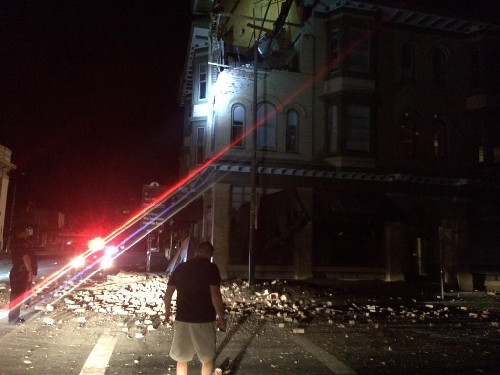
The recent Napa Valley earthquake might have helped nudge Northern California residents out of their complacency.

But Archuleta worries that people will still ignore the new warning because of the forecast's long-range nature — 30 years — and procrastinate on the upgrades needed to make their homes more earthquake resilient.

People need to realize that this doesn’t mean you’re safe for 30 years, he says. “What they need to think about is that it could happen tomorrow or a week from tomorrow,” he explains. “We don’t know when, but we do know that inevitably there will be an earthquake.”
0 Replies
 
Butrflynet
 
  1  
Reply Sat 1 Nov, 2014 01:53 pm
M6.9 - FIJI REGION

Preliminary Earthquake Report
Magnitude 6.9
Date-Time
1 Nov 2014 18:57:22 UTC
1 Nov 2014 06:57:22 near epicenter
1 Nov 2014 12:57:22 standard time in your timezone
Location 19.686S 177.803W
Depth 421 km
Distances
142 km (88 mi) NE of Ndoi Island, Fiji
315 km (195 mi) WNW of Nuku`alofa, Tonga
431 km (267 mi) ESE of Suva, Fiji
468 km (290 mi) SE of Lambasa, Fiji
545 km (337 mi) ESE of Nadi, Fiji
0 Replies
 
Butrflynet
 
  1  
Reply Mon 3 Nov, 2014 12:17 am
M4.0 - OFF THE COAST OF OREGON

Preliminary Earthquake Report
Magnitude 4.0
Date-Time
3 Nov 2014 05:54:07 UTC
2 Nov 2014 20:54:08 near epicenter
2 Nov 2014 23:54:07 standard time in your timezone
Location 44.191N 129.546W
Depth 10 km
Distances
431 km (267 mi) WNW of Bandon, Oregon
438 km (271 mi) WNW of Coos Bay, Oregon
501 km (310 mi) W of Dallas, Oregon
502 km (311 mi) W of Corvallis, Oregon
523 km (324 mi) W of Salem, Oregon
0 Replies
 
Butrflynet
 
  1  
Reply Wed 5 Nov, 2014 08:15 pm
Ongoing Earthquake Swarm in Northwestern Nevada

Posted: Nov 05, 2014 6:58 PM MST
Updated: Nov 05, 2014 6:58 PM MST
From the University of Nevada:

A swarm of earthquakes in a sparsely populated area of far northwest Nevada that began on July 12, 2014, has increased in intensity over the past several days. This activity is located about 40 miles southeast of Lakeview, Ore., and 40 miles northeast of Cedarville, Calif. During the past three months the Nevada Seismological Laboratory, in collaboration with the U.S. Geological Survey and seismic networks in Washington and Oregon, has recorded 42 earthquakes larger than Magnitude 3, and about 550 earthquakes larger than Magnitude 2. Three Magnitude 4+ events have occurred since Oct. 30, with the largest event of the sequence, Magnitude 4.6, at 11:23 p.m., Nov. 4, 2014 (PST).

This activity resembles the 1968 Adel, Ore., swarm, which also lasted several months and included three events of approximately Magnitude 5; the Adel swarm caused moderate damage. Another analog is the 2008 “Mogul-Somersett” swarm in west Reno. This swarm also consisted of an increasingly vigorous series of earthquakes over a two-month period, leading to a Magnitude 5 event. The Mogul sequence also caused moderate local damage.

Following any sequence of earthquakes similar to what is occurring in northwest Nevada, there is a small increase in the probability of a larger event. Whether a larger event will occur in the northwest Nevada swarm cannot be predicted or forecast. However, large earthquakes can happen anywhere in Nevada, and we encourage citizens to take steps to prepare for the potential for strong ground shaking.

The Nevada Seismological Laboratory at the University of Nevada, Reno, the Pacific Northwest Seismic Network at the University of Washington, the Oregon Department of Geology and Mineral Industries and the U.S. Geological Survey are closely monitoring the earthquake activity in northwest Nevada.
 

Related Topics

did the earth move for you? - Discussion by ehBeth
Big quake in Haiti - Discussion by sozobe
7.9 Quake in Nepal - Discussion by Butrflynet
7.5 Major Quake - Guerrero, Mexico - Discussion by Butrflynet
Quake on Canada's East Coast - Question by Butrflynet
Myanmar - Earthquake - Question by ehBeth
7.5 Quake in Indian Ocean - Discussion by Butrflynet
 
Copyright © 2024 MadLab, LLC :: Terms of Service :: Privacy Policy :: Page generated in 0.03 seconds on 04/23/2024 at 07:22:26